Hot Springs, Montana
Hot Springs (Montana Salish: nayyákʷ, Kutenai: Kutmiʔk[3]) is a town on the Flathead Indian Reservation in Sanders County, Montana, United States. The population was 557 at the 2020 census.[4]
Hot Springs, Montana
nayyákʷ Kutmiʔk | |
|---|---|
| Motto(s): "Limp in, Leap out" | |
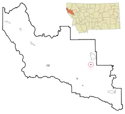 Location of Hot Springs, Montana | |
| Coordinates: 47°36′32″N 114°40′19″W | |
| Country | United States |
| State | Montana |
| County | Sanders |
| Area | |
| • Total | 0.38 sq mi (0.99 km2) |
| • Land | 0.38 sq mi (0.99 km2) |
| • Water | 0.00 sq mi (0.00 km2) |
| Elevation | 2,841 ft (866 m) |
| Population (2020) | |
| • Total | 557 |
| • Density | 1,450.52/sq mi (560.51/km2) |
| Time zone | UTC-7 (Mountain (MST)) |
| • Summer (DST) | UTC-6 (MDT) |
| ZIP code | 59845 |
| Area code | 406 |
| FIPS code | 30-37825 |
| GNIS feature ID | 0772580[2] |
| Website | townofhotspringsmt |
Founded in 1910, the town was incorporated in 1929.
Previously it was known as both Camas and Camas Hot Springs for the camas plant that grows abundantly in the region.[5]
Geography
According to the United States Census Bureau, the town has a total area of 0.38 square miles (0.98 km2), all land.[6]
It is located near several mineral hot springs, from which the town derives its name.
Communications
The town of Hot Springs was featured in an article in Time Magazine regarding cell phone service. In 2012, the town had a single cell phone tower operated by the Hot Springs Telephone Company, with ATT service. Wi-Fi was only available in selected locations in and around town.[7]
Demographics
| Census | Pop. | Note | %± |
|---|---|---|---|
| 1930 | 447 | — | |
| 1940 | 663 | 48.3% | |
| 1950 | 733 | 10.6% | |
| 1960 | 585 | −20.2% | |
| 1970 | 664 | 13.5% | |
| 1980 | 601 | −9.5% | |
| 1990 | 411 | −31.6% | |
| 2000 | 531 | 29.2% | |
| 2010 | 544 | 2.4% | |
| 2020 | 557 | 2.4% | |
| U.S. Decennial Census[8][4] | |||
2010 census
As of the census[9] of 2010, there were 544 people, 297 households, and 108 families living in the town. The population density was 1,431.6 inhabitants per square mile (552.7/km2). There were 392 housing units at an average density of 1,031.6 per square mile (398.3/km2). The racial makeup of the town was 77.8% White, 0.6% African American, 9.9% Native American, 0.2% Asian, 1.7% from other races, and 9.9% from two or more races. Hispanic or Latino of any race were 4.2% of the population.
There were 297 households, of which 17.8% had children under the age of 18 living with them, 22.2% were married couples living together, 10.1% had a female householder with no husband present, 4.0% had a male householder with no wife present, and 63.6% were non-families. 55.9% of all households were made up of individuals, and 23.2% had someone living alone who was 65 years of age or older. The average household size was 1.72 and the average family size was 2.64.
The median age in the town was 54 years. 15.8% of residents were under the age of 18; 5.6% were between the ages of 18 and 24; 14.7% were from 25 to 44; 37% were from 45 to 64; and 26.8% were 65 years of age or older. The gender makeup of the town was 47.2% male and 52.8% female.
2000 census
As of the census[10] of 2000, there were 531 people, 280 households, and 126 families living in the town. The population density was 1,739.1 inhabitants per square mile (671.5/km2). There were 385 housing units at an average density of 1,260.9 per square mile (486.8/km2). The racial makeup of the town was 84.93% White, 0.19% African American, 9.98% Native American, 0.19% Asian, 1.13% from other races, and 3.58% from two or more races. Hispanic or Latino of any race were 3.58% of the population.
There were 280 households, out of which 16.4% had children under the age of 18 living with them, 33.6% were married couples living together, 8.9% had a female householder with no husband present, and 55.0% were non-families. 50.7% of all households were made up of individuals, and 23.6% had someone living alone who was 65 years of age or older. The average household size was 1.81 and the average family size was 2.64.
In the town, the population was spread out, with 18.3% under the age of 18, 2.4% from 18 to 24, 21.8% from 25 to 44, 29.2% from 45 to 64, and 28.2% who were 65 years of age or older. The median age was 50 years. For every 100 females there were 87.0 males. For every 100 females age 18 and over, there were 84.7 males.
The median income for a household in the town was $12,663, and the median income for a family was $21,786. Males had a median income of $26,250 versus $13,750 for females. The per capita income for the town was $12,690. About 33.3% of families and 38.2% of the population were below the poverty line, including 50.8% of those under age 18 and 20.2% of those age 65 or over.
Culture
Hot Springs is popular to visitors for its hot springs pools where people come and soak in the mineral water.
Another big attraction is the "Hot Springs Artists Society" which does many things but is most noted for bringing musical groups to a local Hotel at least twice per week, Fridays and Saturdays. The music genres are generally "Blues," "Folk," "Country" or some combination of all three from local and visiting artists. Occasionally there are special concerts of artists which may include a special concert on Sunday. In summer, the stage moves outdoors.[11][12][13]
Popular with tourists is also LaRue Hot Springs Museum.[14]
Preston Hot Springs Library serves the area.[15]
Education
Hot Springs School District educates students from kindergarten through 12th grade.[16] In the 2021-2022 school year, 179 students were enrolled.[17] The district has 3 schools.
Hot Springs High School's team name is Savage Heat.[18]
Media
The Clark Fork Valley Press is the newspaper serving Sanders County. It is printed weekly and also has an e-edition.[19]
The FM radio station KJFK-LP is licensed in Hot Springs.[20]
Infrastructure
Montana Highway 28 is east of town.
The Hot Springs Airport is a county-owned public-use airport located two nautical miles (4 km) east of the central business district of Hot Springs.[21] The nearest commercial airports are Glacier Park International Airport, 73 miles (117 km) north, or Missoula Montana Airport, 71 miles (114 km) south.
Sanders County Transportation operates shuttle vans and buses to and from several cities and towns in Sanders, Flathead and Missoula Counties.
See also
References
- "ArcGIS REST Services Directory". United States Census Bureau. Retrieved September 5, 2022.
- U.S. Geological Survey Geographic Names Information System: Hot Springs, Montana
- Adam N. Johnson, Regina Sievert and Michael Durglo et al. Indigenous Knowledge and Geoscience on the Flathead Indian Reservation, Northwest Montana: Implications for Place-Based and Culturally Congruent Education. Journal of Geoscience Education. Vol. 62(2):187-202. DOI: 10.5408/12-393.1 https://files.eric.ed.gov/fulltext/EJ1163600.pdf
- "U.S. Census website". United States Census Bureau. Retrieved November 2, 2021.
- "Hot Springs". Montana Place Names Companion. Montana Historical Society. Retrieved 5 April 2021.
- "US Gazetteer files 2010". United States Census Bureau. Archived from the original on 2012-01-25. Retrieved 2012-12-18.
- "Cell Service Gets Mixed Reception". Time Magazine. 2012-08-27. Archived from the original on August 16, 2012. Retrieved 7 June 2013.
- "Census of Population and Housing". Census.gov. Retrieved June 4, 2015.
- "U.S. Census website". United States Census Bureau. Retrieved 2012-12-18.
- "U.S. Census website". United States Census Bureau. Retrieved 2008-01-31.
- Hot Springs Chamber of Commerce, http://www.hotspringsmtchamber.org/businesses.htm
- The Symes Hotel, http://www.symeshotsprings.com/
- Hot Springs Artists Society, http://www.hotspringsartists.org/
- LaRue Hot Springs Museum Symes Hot Springs Hotel
- "Preston Hot Springs Library". Preston Hot Springs Library. Retrieved 13 April 2021.
- "Hot Springs School District". Hot Springs School District. Retrieved 13 April 2021.
- "Hot Springs K-12". National Center for Education Statistics. Retrieved 9 October 2023.
- "Member Schools". Montana High School Association. Retrieved 19 April 2021.
- "Latest News". Clark Fork Valley Press/Mineral Independent. Retrieved 31 August 2023.
- "KJFK-LP". FCC. Retrieved 9 October 2023.
- FAA Airport Form 5010 for S09 PDF. Federal Aviation Administration. Effective 25 August 2011.
External links
Municipalities and communities of Sanders County, Montana, United States | ||
|---|---|---|
| City | 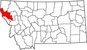 Sanders County map | |
| Towns | ||
| CDPs | ||
| Indian reservation | ||
| Footnotes | ‡This populated place also has portions in an adjacent county or counties | |