Hurricane River
The Hurricane River is a 6.4-mile-long (10.3 km)[2] river in Alger County in the Upper Peninsula of Michigan in the United States. It empties into Lake Superior in the Pictured Rocks National Lakeshore. There is a campground at the mouth of the river which is also the beginning of a trail that leads past various old shipwrecks to the historic Au Sable Lighthouse.[3] The mouth of the river is also very near the eastern end of a stretch of relatively straight shoreline known as Twelvemile Beach.
 Hurricane River near the mouth |
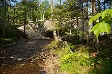 New Bridge on H-58 over the Hurricane river |
| Hurricane River | |
|---|---|
 Mouth of the Hurricane River at Lake Superior | |
| Location | |
| Country | United States |
| Physical characteristics | |
| Source | |
| • location | Burt Township, Alger County, Michigan |
| • coordinates | 46.60525°N 86.096°W[1] |
| Mouth | |
• location | Lake Superior, Michigan |
• coordinates | 46.66607°N 86.16794°W |
| Length | 6.4 mi (10.3 km) |
See also
References
- "Hurricane River". Geographic Names Information System. United States Geological Survey, United States Department of the Interior.
- U.S. Geological Survey. National Hydrography Dataset high-resolution flowline data. The National Map Archived 2012-03-29 at the Wayback Machine, accessed January 3, 2012
- Pure Michigan accessed March 25, 2011
External links
Wikimedia Commons has media related to Hurricane River.
- Michigan Streamflow Data from the USGS
- Information on campgrounds in the Pictured Rocks National Lakeshore
This article is issued from Wikipedia. The text is licensed under Creative Commons - Attribution - Sharealike. Additional terms may apply for the media files.