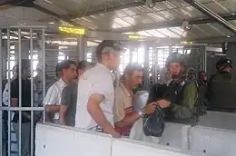
Huwara checkpoint
The Huwara checkpoint (Hebrew: מחסום חווארה; Arabic: حاجز حوارة) is a formerly major checkpoint operated by the Israel Defense Forces at one of the four main exits of Nablus. Situated to the south of the city, it was named after the nearby town of Huwara. It was established in October 2000, during the Second Intifada.
History
In 2002, the checkpoint was open from morning to evening. Later, it remained open for 24 hours everyday.[1] All vehicles were required to have special permits and be searched.
In 2008, renovations were carried out to ease the overcrowding.[2]
Conditions at Hawara were relaxed in July 2009. The checkpoint was opened to allow pedestrians to cross freely without being searched.[3] Palestinian vehicles have sometimes faced random inspections.[1]
In 2011, Israeli newspapers reported that the checkpoint would be removed,[4] but according to the Palestinian human rights organization Al-Haq, the checkpoint is still in use as of 2014.[5] According to B'Tselem, the checkpoint is infrequently in use.
Violent incidents
On 24 March 2004, a 16-year-old Palestinian boy known as Hussam Abdo tried to pass through the checkpoint while having an explosive belt strapped to his body for an attempted suicide attack.[6] However, he failed to do so and subsequently surrendered to Israeli soldiers at the checkpoint.
In May 2005, a 15-year-old Palestinian boy was arrested at the checkpoint with two pipe bombs inside a black bag, apparently instructed to give them to someone in Israel.[7] In November 2007, two Palestinian teenagers were detained for interrogation after they were found to be carrying three bombs; an Israeli sapper detonated them without incident.[8] In September 2008, during Ramadan, a Palestinian woman threw acid at an Israeli soldier's face while she was passing through the checkpoint, leaving him blind in one eye.[2] She was subsequently captured and arrested after trying to flee from the checkpoint.[9][10][11]
References
- "Behind the Headlines: Improving Palestinian quality of life". Ministry of Foreign Affairs (Israel). Retrieved 2014-01-07.
- Renovations of notorious Hawara checkpoint meant to benefit soldiers and Palestinians
- "Key IDF Checkpoint Neutralized". Israel National News. 2009-01-07. Retrieved 2014-01-07.
- IDF to remove major West Bank checkpoint to enable Palestinian movement. Chaim Levinson, Haaretz, 11 February 2011
- Palestinians Suffer Ill-Treatment at Huwwara Checkpoint. Al-Haq, 12 December 2013
- "Teen Bomber Stopped At West Bank". CBS News. CBS. 2004-03-24. Retrieved 2007-10-09.
- Second teen caught with bombs this week at Hawara checkpoint
- Youths with bombs stopped at Hawara
- Weiss, Efrat (2008-09-10). "Palestinian woman throws acid on soldier at Hawara checkpoint". Ynetnews. Retrieved 2023-10-26.
- Weiss, Efrat (2008-09-22). "Palestinian woman pours acid on soldier". Ynetnews. Retrieved 2023-10-26.
- "Palestinian sprays acid on face of IDF soldier at Hawara checkpoint". The Jerusalem Post | JPost.com. 2008-09-10. Retrieved 2023-10-26.