Ililabalekan
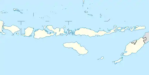
Ililabalekan volcano is located on a notable peninsula within the southwestern region of Lembata Island which is a part of Indonesia, previously known as Lomblen Island. On the southeastern slope of this steep-sided Volcano, a satellite cone has formed. The summit of Mount Labalekan features four craters, including one that harbors a lava dome and two smaller explosion pits. While there is no recorded history of eruptions from this volcano, it does exhibit fumaroles near its summit.[1]
| Ililabalekan | |
|---|---|
 Ililabalekan | |
| Highest point | |
| Elevation | 1,018 m (3,340 ft) |
| Listing | Ribu |
| Coordinates | 8.55°S 123.38°E |
| Geography | |
| Location | Lembata Island, Indonesia |
| Geology | |
| Mountain type | Stratovolcano |
| Last eruption | Unknown |
See also
References
- "Global Volcanism Program | Ililabalekan". Smithsonian Institution | Global Volcanism Program. Retrieved 2023-10-28.
This article is issued from Wikipedia. The text is licensed under Creative Commons - Attribution - Sharealike. Additional terms may apply for the media files.