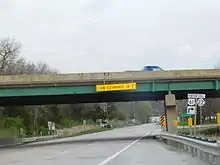
Iowa Highway 22
Iowa Highway 22 (Iowa 22) is a 98-mile (158 km) west–east state highway that traverses primarily rural areas in east-central Iowa. The highway begins near Thornburg at an intersection with Iowa Highway 21 and ends in southwestern Davenport, at U.S. Highway 61 Business.
Iowa Highway 22 | ||||
|---|---|---|---|---|
Iowa 22 highlighted in red | ||||
| Route information | ||||
| Maintained by Iowa DOT | ||||
| Length | 97.905 mi[1] (157.563 km) | |||
| Major junctions | ||||
| West end | ||||
| East end | ||||
| Location | ||||
| Country | United States | |||
| State | Iowa | |||
| Counties | ||||
| Highway system | ||||
| ||||
Route description

Iowa Highway 22 begins west of Thornburg at Iowa Highway 21. It continues east through Keswick and Webster. Between Webster and South English, Iowa 22 is overlapped with Iowa Highway 149. It continues east from South English through Kinross and Wellman before intersecting Iowa Highway 1 at Kalona. It proceeds east from Kalona to go through Riverside and then intersects U.S. Highway 218 and Iowa Highway 27. After crossing the Iowa River, it goes through Nichols, where a short overlap with Iowa Highway 70 begins. It then continues eastward and intersects U.S. Highway 61 at Muscatine. It goes around the west and north city limits of Muscatine before intersecting Iowa Highway 38 and Business US 61 and turns south into Muscatine. It then turns east along a route next to the Mississippi River and passes through Buffalo before intersecting Interstate 280 at Davenport. It then turns north to end at U.S. 61.
To locals, Iowa Highway 22 is most notable as one of two main highways connecting Muscatine and Davenport (U.S. Highway 61 being the other). This 24-mile (39 km) eastern section of highway follows the Mississippi River.
The segment of the highway between Muscatine and Davenport is part of the Great River Road.
History
Iowa Highway 22 was designated in 1926, and followed what is now U.S. Highway 61 between Muscatine and Davenport, passing through Blue Grass; U.S. 61 followed the Mississippi River route at the time. The highway was extended to Thornburg in 1931.
For years, several sections of Iowa Highway 22 was either gravel or had a bituminous surface. One of these sections — the section between Muscatine and Blue Grass — was paved in 1957, the same year U.S. 61 and Iowa Highway 22 switched routes; U.S. 61 now went through Blue Grass, while Iowa Highway 22 now followed the Mississippi River through Buffalo.
The last segment — between U.S. Highway 218 east of Riverside to Iowa Highway 405 north of Lone Tree, was upgraded from bituminous to paved in 1988.
Major intersections
| County | Location | mi[1] | km | Destinations | Notes | |||
|---|---|---|---|---|---|---|---|---|
| Keokuk | Prairie Township | 0.000 | 0.000 | |||||
| Webster | 10.644 | 17.130 | Western end of Iowa 149 overlap | |||||
| South English | 14.990 | 24.124 | Eastern end of Iowa 149 overlap | |||||
| Washington | Kalona | 35.215 | 56.673 | |||||
| Riverside | 44.124 | 71.011 | ||||||
| Johnson |
No major junctions | |||||||
| Muscatine | Nichols | 57.284 | 92.190 | Western end of Iowa 70 overlap | ||||
| Pike Township | 60.171 | 96.836 | Eastern end of Iowa 70 overlap | |||||
| Bloomington Township | 69.520 | 111.882 | Western end of US 61 and Iowa 92 overlaps | |||||
| Muscatine | 73.546 | 118.361 | Eastern end of US 61 overlap; western end of US 61 Business / Iowa 38 overlap | |||||
| 74.814 | 120.401 | Eastern end of US 61 Business / Iowa 38 / Iowa 92 overlap | ||||||
| Scott | Davenport | 96.815 | 155.809 | |||||
| 97.905 | 157.563 | |||||||
1.000 mi = 1.609 km; 1.000 km = 0.621 mi
| ||||||||
References
- 2009 Volume of Traffic on the Primary Road System of Iowa (PDF) (Report). Iowa Department of Transportation. January 1, 2009. Retrieved January 19, 2011.
