Irvine Creek (Ontario)
Irvine Creek is a creek in the municipality of Centre Wellington, Wellington County in southwestern Ontario, Canada. It is in the Great Lakes Basin and is a right tributary of the Grand River.[1][2][3]
| Irvine Creek | |
|---|---|
 Sideroad 15 over Irvine Creek at Living Springs | |
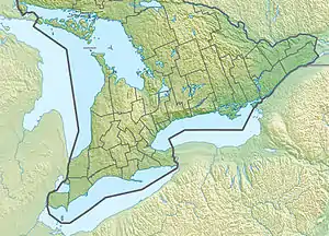
 Location of the mouth in southern Ontario | |
| Location | |
| Country | Canada |
| Province | Ontario |
| Region | Southwestern Ontario |
| County | Wellington |
| Municipality | Centre Wellington |
| Physical characteristics | |
| Source confluence | Unnamed field |
| • location | West Garafraxa township |
| • coordinates | 43°49′15″N 80°23′33″W |
| • elevation | 453 m (1,486 ft) |
| Mouth | Grand River |
• location | Elora |
• coordinates | 43°40′54″N 80°26′07″W[1] |
• elevation | 366 m (1,201 ft) |
| Basin features | |
| River system | Great Lakes Basin |
The creek begins at the confluence of two unnamed tributary streams in geographic West Garafraxa Township near the settlement of Dracon and flows southeast towards Lake Belwood. Before reaching the lake, it then turns southwest, then northwest and reaches the settlement of Living Springs. It turns southwest, passes under Ontario Highway 6, enters geographic Nichol Township, and reaches the community of Salem. The creek then flows southwest and reaches its mouth at the Grand River at the community of Elora. The Grand River flows to Lake Erie.
See also
- David Street Bridge - a vehicular bridge that crosses over Irvine Creek.
References
- "Irvine Creek". Geographical Names Data Base. Natural Resources Canada. Retrieved 2017-03-10.
- Map 2 (PDF) (Map). 1 : 700,000. Official road map of Ontario. Ministry of Transportation of Ontario. 2015-01-01. Retrieved 2017-03-10.
- Restructured municipalities - Ontario map #6 (Map). Restructuring Maps of Ontario. Ontario Ministry of Municipal Affairs and Housing. 2006. Retrieved 2017-03-10.
This article is issued from Wikipedia. The text is licensed under Creative Commons - Attribution - Sharealike. Additional terms may apply for the media files.