List of islands of Sri Lanka
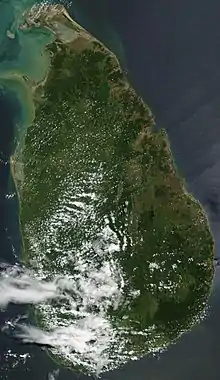
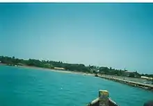
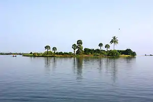
Sri Lanka is an island country in the Indian Ocean. There are also a number of smaller islands around Sri Lanka, most abundantly in the north and eastern parts of the islands. The most prominent islets are west of the Jaffna Peninsula in the Northern Province. Many of these islands were given Dutch names during the Dutch colonial period, only a few of these names are still in use today.[1]
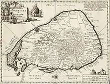
Sri Lanka has a total area of 65,610 km2, with 64,740 km2 of land and 870 km2 of water, and a coastline of 1,340 km long. The main island of Sri Lanka has an area of 65,268 km2 and is the 25th largest island in the world by area.[2] Dozens of offshore islands account for the remaining 342 km2 of area.
List of islands
| Island | Province | District | Divisional Secretariat | Coordinates | Area (km2)[3] | Population (approx)[4] | Notes |
|---|---|---|---|---|---|---|---|
| Sri Lanka | — | — | — | — | 65,268 | 22,157,000 | Main island of Sri Lanka. |
| Ambanttativu | North Western | Puttalam | 8°12′40″N 79°46′06″E | 0.17 | In Puttalam Lagoon Sinhala: Sambanda-doova. | ||
| Analaitivu | Northern | Jaffna | Islands North (Kayts) | 9°40′01″N 79°46′32″E | 4.82 | 2,200 | Dutch: Rotterdam, Annelletivo Sinhala: annaladoova. |
| Bone Island | Eastern | Batticaloa | Manmunai North | 7°45′12″N 81°41′24″E | 0.02 | In Batticaloa Lagoon. | |
| Buffalo Island | Eastern | Batticaloa | Manmunai North | 7°41′23″N 81°41′58″E | 5.18 | In Batticaloa Lagoon. | |
| Challitivu | Eastern | Batticaloa | Koralai Pattu North | 8°06′40″N 81°27′49″E | 0.09 | Sinhala: Galdoova | |
| Chirutivu (Sirutivu) | Northern | Jaffna | Islands South (Velanai) | 9°38′36″N 80°00′37″E | 0.28 | Between Mandativu and Jaffna Peninsula.
| |
| Clappenburg Island | Eastern | Trincomalee | Town & Gravets | 8°31′50″N 81°12′37″E | 0.05 | In Koddiyar Bay. | |
| Elephant Island | Eastern | Trincomalee | Town & Gravets | 8°31′59″N 81°14′00″E | 0.06 | In Koddiyar Bay. | |
| Eluvaitivu | Northern | Jaffna | Islands North (Kayts) | 9°42′03″N 79°48′38″E | 1.40 | 800 | Sinhala: Eluvadoova |
| Erumaitivu | Northern | Kilinochchi | Poonakary | 9°20′15″N 80°03′20″E | 1.04 | Sinhala: Mahisadoova | |
| Erumaitivu | North Western | Puttalam | 8°16′07″N 79°46′44″E | 0.90 | In Dutch Bay. Sinhala: Mahisadoova | ||
| Great Sober Island | Eastern | Trincomalee | Town & Gravets | 8°32′39″N 81°12′34″E | 0.62 | Wildlife sanctuary in China Bay. | |
| Henativu/Havativu | North Western | Puttalam | 7°58′22″N 79°49′09″E | 0.78 | In channel between Puttalam Lagoon and Mundal Lagoon. Sinhala: Haavadoova. | ||
| Ippantivu | North Western | Puttalam | 8°19′49″N 79°48′22″E | 0.76 | In Dutch Bay. Sinhala: Ibbandoova. | ||
| Iranaitivu North | Northern | Kilinochchi | Poonakary | 9°17′31″N 79°58′54″E | 4.22 | Dutch: Enkhuizen. Sinhala: Erandoova. | |
| Iranaitivu South | Northern | Kilinochchi | Poonakary | 9°16′50″N 80°00′04″E | 1.71 | Dutch Hoorn. Sinhala: Uoona doova. | |
| Kachchatheevu | Northern | Jaffna | Neduntivu (Delft) | 9°23′16″N 79°31′37″E | 0.68 | Pali: Kachchatheetha. Sinhala: Kachchadoova. | |
| Kakaraitivu Island | Northern | Jaffna? | Neduntivu (Delft)? | 9°26′23″N 79°53′14″E | 0.14 | Uninhabited | Dutch: Calienye. Sinhala: Sakkaradoova. |
| Kakkativu | Northern | Kilinochchi | Poonakary | 9°19′01″N 80°04′51″E | 1.10 |
Sinhala: Kaakadoova | |
| Kalliaditivu | Northern | Mannar | 8°56′54″N 79°54′42″E | 1.71 |
Sinhala: Galadi doova | ||
| Kanantivu | Northern | Jaffna | Islands South (Velanai) | 9°37′33″N 79°51′26″E | 1.22 | Between Kayts and Pungudutivu. Sinhala: Kaennadoova. | |
| Karaditivu | North Western | Puttalam | 7°54′42″N 79°48′54″E | 0.09 | In channel between Puttalam Lagoon and Mundal Lagoon. Sinhala: Karadiva | ||
| Karaitivu | Northern | Jaffna | Islands South (Velanai) | 9°36′27″N 79°49′48″E | 0.97 | Adjacent (north) of Pungudutivu. | |
| Karaitivu | Northern | Jaffna | Karaitivu (Karainagar) | 9°44′03″N 79°52′33″E | 22.95 | 8,600 | Dutch: Amsterdam. |
| Karaitivu | North Western | Puttalam | 8°27′45″N 79°47′15″E | West of Portugal Bay. | |||
| Velanai | Northern | Jaffna | Islands North (Kayts) atuvan& Islands South (Velanai) | 9°39′09″N 79°54′11″E | 64.01 | 16,300 | Named Leiden by Dutch. Sinhala: Uruthota (Kayts); Bellana (Velanai) |
| Kurikadduvan | Northern | Jaffna | Islands South (Velanai) | 9°35′43″N 79°47′40″E | 0.38 | Adjacent (north west) of Naduturitti.
| |
| Little Sober Island | Eastern | Trincomalee | Town & Gravets | 8°32′35″N 81°12′54″E | 0.07 | Wildlife sanctuary in China Bay. | |
| Mandaitivu | Northern | Jaffna | Islands South (Velanai) | 9°36′48″N 79°59′44″E | 7.56 | 900 |
Sinhala: Mandadoova |
| Mannar | Northern | Mannar | Mannar Town | 9°03′10″N 79°49′42″E | 126.46 |
Sinhala: Mannaram doopatha | |
| Mantivu | Eastern | Batticaloa | Manmunai North | 7°42′03″N 81°39′43″E | 0.38 | In Batticaloa Lagoon. Sinhala: Maandoova | |
| Mantivu | North Western | Puttalam | 7°55′57″N 79°49′12″E | 0.50 | In channel between Puttalam Lagoon and Mundal Lagoon. Sinhala: Maandoova | ||
| Maripututivu | North Western | Puttalam | 8°10′33″N 79°44′59″E | 0.10 | In Puttalam Lagoon.
| ||
| Marthand | Eastern | Batticaloa | Koralai Pattu North | 8°06′51″N 81°26′34″E | 0.18 |
Sinhala: Malkadola. | |
| Mattutivu | North Western | Puttalam | 8°13′02″N 79°47′00″E | 0.12 | In Puttalam Lagoon. Sinhala: Maddu doova | ||
| Nachuvantivu | Eastern | Batticaloa | Koralai Pattu | 7°56′13″N 81°32′18″E | 2.11 | In Vandeloos Bay. Sinhala: Naapitadoova. | |
| Naduturitti | Northern | Jaffna | Islands South (Velanai) | 9°35′05″N 79°47′54″E | 0.88 | Adjacent (south west) of Pungudutivu.
| |
| Nainativu | Northern | Jaffna | Islands South (Velanai) | 9°36′15″N 79°46′04″E | 4.22 | 2,700 | Dutch: Haarlem Sinhala: Naga Deepa. |
| Neduntivu | Northern | Jaffna | Neduntivu (Delft) | 9°30′48″N 79°41′22″E | 47.17 | 4,200 | Dutch: Delft. Sinhala: Maedundoova. |
| Neduntivu | North Western | Puttalam | 8°14′06″N 79°46′45″E | 0.10 | In Dutch Bay. Sinhala: Maedundoova. | ||
| Oddakarentivu | North Western | Puttalam | 8°16′37″N 79°45′54″E | 0.20 | In Dutch Bay. Sinhala: Uddakadoova. | ||
| Palaitivu | Northern | Jaffna | Islands South (Velanai) | 9°37′22″N 79°49′10″E | 0.16 | Adjacent (north) of Pungudutivu. | |
| Palaitivu | Northern | Kilinochchi | Poonakary | 9°28′39″N 80°00′45″E | 1.81 | Named Galue by Dutch. Sinhala: Paludoova. | |
| Paratitivu | Northern | Jaffna | Islands North (Kayts) | 9°41′06″N 79°47′32″E | 0.38 | Uninhabited | Between Analativu and Eluvaitivu.
Sinhal: Sinhala: Paludoova. |
| Periya Arichchal | North Western | Puttalam | 8°17′59″N 79°47′45″E | 0.32 | In Dutch Bay. Sinhala: Maha Arakgala. | ||
| Periya Kayankerni (Periyawattava) | Eastern | Batticaloa | Koralai Pattu | 7°57′20″N 81°32′20″E | 1.81 | In Vandeloos Bay. Sinhala: Kaayamkaenna. | |
| Periyativu | Eastern | Batticaloa | Manmunai South West | 7°38′22″N 81°43′39″E | 0.13 | In Batticaloa Lagoon. Sinhala: Mahadoova. | |
| Periyativu | North Western | Puttalam | 7°56′57″N 79°48′58″E | 1.10 | In channel between Puttalam Lagoon and Mundal Lagoon. Sinhala: Mahadoova. | ||
| Pigeon Island (Large & Small) | Eastern | Trincomalee | Kuchaveli | 8°43′20″N 81°12′15″E | 0.01 | Uninhabited | One of the two marine national parks of Sri Lanka. |
| Puliyanthivu | Eastern | Batticaloa | Manmunai North | 7°42′37″N 81°41′41″E | 1.56 | 7,034 | Batticaloa city Sinhala: Kotidoova. |
| Puliyantivu | Northern | Jaffna | Islands North (Kayts) | 9°38′52″N 79°46′28″E | 0.44 | Adjacent (south east) of Analativu. Sinhala: Kotidoova. | |
| Puliyantivu | Northern | Mannar | 8°57′19″N 79°54′01″E | 0.90 |
Sinhala: Kotidoova. | ||
| Pullupiddi | North Western | Puttalam | 8°11′21″N 79°46′40″E | 0.11 | In Puttalam Lagoon. Sinhala: Kotipitiya. | ||
| Pungudutivu | Northern | Jaffna | Islands South (Velanai) | 9°35′08″N 79°50′05″E | 22.56 | 3,600 | Dutch: Middleburg. Pali/Sinhala: Punguthdeepa |
| Round Island | Eastern | Trincomalee | Town & Gravets? | 8°30′46″N 81°13′34″E | 0.04 | In Koddiyar Bay. | |
| Serayativu | Eastern | Batticaloa | Manmunai West | 7°39′08″N 81°42′04″E | 0.46 | In Batticaloa Lagoon. Sinhala: Seradoova | |
| Sinna Arichchal | North Western | Puttalam | 8°17′02″N 79°47′32″E | 0.16 | In Dutch Bay. Sinhala: Podi Arakgal. | ||
| Siriyativu | Eastern | Batticaloa | Manmunai Pattu | 7°38′06″N 81°43′55″E | 0.03 | In Batticaloa Lagoon. Sinhala: Seruvadoova. | |
| Thimilathiu West | Eastern | Batticaloa | 7°42′17.40″N 81°40′37.40″E | Location of SLAF Batticaloa. Sinhala: Kevuldoova | |||
| Thorattapputti | Northern | Jaffna | Valikamam West (Chankanai) | 9°44′55″N 79°54′23″E | 0.14 | Between Karaitivu and Jaffna Peninsula. Sinhala: Doratumukka. | |
| Udayurputi | North Western | Puttalam | 8°10′07″N 79°48′31″E | 0.42 | In Puttalam Lagoon. Sinhala: Udukurupoththa. | ||
See also
References
- Bassett, Ralph Henry. "12 The Islands". Romantic Ceylon: its history, legend, and story. pp. 274–310. ISBN 81-206-1274-4.
- Yapa, Vijitha (1996). Francis Dorai (ed.). Insight Pocket Guides: Sri Lanka. APA Publications (HK). ISBN 962-421-644-4.
- "Sri Lanka – Island". SatelliteViews.net.
- "LK0000956 DISTRICT : Jaffna DS Division : Velanai" (PDF). Administrative Map. UN OCHA. 13 August 2007. Archived from the original (PDF) on 22 October 2007.
- "LKM0088 DISTRICT : Jaffna DS Division : Kayts" (PDF). Administrative Map. UN OCHA. 20 May 2008.
- Dutch heritage of Sri Lanka
- "Joshua Calder's World Island Info – Largest Islands of the World". Worldislandinfo.com. Retrieved 30 January 2016.
- "Table 05 (Geo., Topography) Islands in Sri Lanka". Sri Lanka Statistics.
- "Statistical Handbook 2009". Jaffna District Secretariat. Archived from the original on 26 March 2010.
