Xgħajra
Xgħajra (Maltese: Ix-Xgħajra) is a small village in the South Eastern Region of Malta. It is located on the coast, about halfway between Valletta and Marsaskala. Its local football club is known as the Xgħajra Tornadoes F.C. Contrary to popular belief, it has no relation to the Gozitan village Xagħra. Its population stood at 1,732 in March 2014.[1]
Xgħajra
Ix-Xgħajra | |
|---|---|
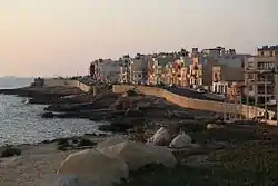 Xgħajra seafront | |
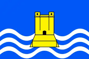 Flag  Coat of arms | |
 | |
| Coordinates: 35°53′11″N 14°32′50″E | |
| Country | |
| Region | South Eastern Region |
| District | Southern Harbour District |
| Borders | Kalkara, Żabbar |
| Government | |
| • Mayor | Neil Attard (PL) |
| Area | |
| • Total | 1 km2 (0.4 sq mi) |
| Population (Jan. 2019) | |
| • Total | 1,830 |
| • Density | 1,800/km2 (4,700/sq mi) |
| Demonym(s) | Xgħajri (m), Xgħajrija (f), Xgħajrin (pl) |
| Time zone | UTC+1 (CET) |
| • Summer (DST) | UTC+2 (CEST) |
| Postal code | XJR |
| Dialing code | 356 |
| ISO 3166 code | MT-63 |
| Patron saint | Our Lady of Graces |
| Day of festa | Sunday after 8 September |
| Website | Official website |
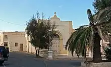
Chapel of Xgħajra
Local Council
The current local council members are:
- Attard, Neil (Sindku) - PL
- Pulis, Rosabelle (vici Sindku) - PL
- Valvo, Anthony - PL
- Camilleri, Raymond - PL
- Borġ, Doris - Independent
Zones in Xgħajra
- San Pietru
- Ta' Alessi
- Ta' Maġġi
- Tal-Qassisin
- Tan-Nisa
- Tumbrell
- Wied Glavan
Main Roads
- Dawret ix-Xatt (Strand By-Pass)
- Triq Ħaż-Żabbar (Zabbar Road)
- Triq il-Fortizza tal-Grazzja (Grazzia Fort Street)
- Triq il-Knisja (Church Street)
- Triq it-Torri ta' Alof de Wignacourt (Alof de Wignacourt Tower Street). This road refers to the Santa Maria delle Grazie Tower which the Knights of Malta erected in 1620 during the reign of Grand Master Fra Alof de Wignacourt, which was one of the set of Wignacourt towers. The British demolished the tower to clear a field of fire for the Della Grazie Battery which they constructed in 1888.
Twin towns – sister cities
 Colletorto, Italy
 Le Fauga, France
 Pelplin, Poland
References
- "Estimated Population by Locality 31st March, 2014". Government of Malta. 16 May 2014. Archived from the original on 21 June 2015.
- "Twinning". localgovernment.gov.mt. Government of Malta. Retrieved 18 September 2019.
External links
 Media related to Xgħajra at Wikimedia Commons
| Malta Local councils |
| |
|---|---|---|
| Malta Administrative committees |
| |
| Gozo Local councils | ||
| Gozo Administrative committees | ||
This article is issued from Wikipedia. The text is licensed under Creative Commons - Attribution - Sharealike. Additional terms may apply for the media files.