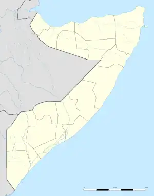
Jalalaqsi
Jalalaqsi (Jalalassi)[1] is a town in the south-central Hiran province of Somalia. It is situated on the Shebelle River, between Buuloburde and Jowhar.
Jalalaqsi | |
|---|---|
Town | |
 Jalalaqsi Location in Somalia | |
| Coordinates: 3°24′0″N 45°35′0″E | |
| Country | |
| State | |
| Region | Hiiraan |
| Time zone | UTC+3 (EAT) |
Demographics
Jalalaqsi has a population of around 60,800 inhabitants.[2] The broader Jalalaqsi District has a total population of 80,724 residents. The district is populated by the Yabar Madaxweyne subclan of Hawadle who also live in bordering Mahaday District in Middle Shabelle [3]
History
In the mid-1988s there were four refugee camps with a population of around 85,000 Somalis in Jalalaqsi. At that time it was the third largest settlement in Somalia after Mogadishu and Hargeisa.[4]
Climate
| Climate data for Jalalaqsi | |||||||||||||
|---|---|---|---|---|---|---|---|---|---|---|---|---|---|
| Month | Jan | Feb | Mar | Apr | May | Jun | Jul | Aug | Sep | Oct | Nov | Dec | Year |
| Average high °C (°F) | 35.6 (96.1) |
37.0 (98.6) |
32.5 (90.5) |
37.5 (99.5) |
34.8 (94.6) |
33.0 (91.4) |
32.0 (89.6) |
32.7 (90.9) |
34.3 (93.7) |
34.9 (94.8) |
35.4 (95.7) |
35.0 (95.0) |
34.6 (94.2) |
| Average low °C (°F) | 22.0 (71.6) |
21.9 (71.4) |
23.2 (73.8) |
23.7 (74.7) |
23.2 (73.8) |
22.3 (72.1) |
21.8 (71.2) |
21.6 (70.9) |
22.3 (72.1) |
22.7 (72.9) |
22.5 (72.5) |
22.1 (71.8) |
22.4 (72.4) |
| Average precipitation mm (inches) | 2 (0.1) |
2 (0.1) |
22 (0.9) |
77 (3.0) |
81 (3.2) |
8 (0.3) |
15 (0.6) |
5 (0.2) |
10 (0.4) |
81 (3.2) |
59 (2.3) |
12 (0.5) |
374 (14.8) |
| Source: Climate-Data.org[5] | |||||||||||||
Notable residents
- Hassan Sheikh Mohamoud, President of Somalia
Notes
- "Jalalaqsi". Archived from the original on 2013-02-09. World Gazetteer
- "Somalia City & Town Population". Tageo. Retrieved 4 October 2013.
- "Regions, districts, and their populations: Somalia 2005 (draft)" (PDF). UNDP. Retrieved 21 September 2013.
- De Montclos & Kagwanja, Journal of Refugee Studies Vol. 13, No. 2 2000: Refugee Camps or Cities? The Socio-economic Dynamics of the Dadaab and Kakuma Camps in Northern Kenya
- "Climate: Jalalaqsi - Climate graph, Temperature graph, Climate table". Climate-Data.org. Retrieved 29 November 2017.
References
This article is issued from Wikipedia. The text is licensed under Creative Commons - Attribution - Sharealike. Additional terms may apply for the media files.