Jenkins Heights
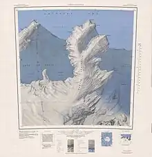
The Jenkins Heights (74°48′S 114°20′W) are a broad ice-covered area rising over 500 metres (1,600 ft) and covering some 25 square miles (65 km2), located south of McClinton Glacier and west of Mount Bray on the Bakutis Coast of Marie Byrd Land, Antarctica. They were mapped by the United States Geological Survey from surveys and U.S. Navy aerial photographs, 1959–66, and were named by the Advisory Committee on Antarctic Names after Charles Jenkins, a geophysicist with the National Oceanic and Atmospheric Administration, and Station Scientific Leader at South Pole Station in the winter party of 1974.[1]
References
![]() This article incorporates public domain material from "Jenkins Heights". Geographic Names Information System. United States Geological Survey.
This article incorporates public domain material from "Jenkins Heights". Geographic Names Information System. United States Geological Survey.