Jogiara
Jogiara is a village in Darbhanga district in the Indian state of Bihar. The village is also served by India Post. Its Postal Code is 847303.[1]
Jogiara | |
|---|---|
Village | |
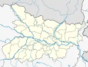 Jogiara Location in Bihar, India  Jogiara Jogiara (India) | |
| Coordinates: 26°24′30″N 85°45′00″E | |
| Country | |
| State | Bihar |
| Region | Mithila |
| District | Darbhanga |
| Official | |
| • Languages | Maithili, Hindi, English |
| Time zone | IST |
| ISO 3166 code | IN-BR |
History
Jogiara is a place of historical importance. The village was never entitled to pay the land revenue due to continuous struggle and fight against the Mughal emperor. The villagers struggled and showed great bravery against the Mughal dynasty. Mithila Maharaja Sir Kameshwar Singh, also known as Darbhanga Maharaja, never levied any land tax on this village. Jogiara village also participated hugely against the British rule.[2]
Jogiara is a base of royal families and culture. The oldest Zamindari status holding house is Haweli Deudhi of Jogiara. This Palace called Deudhi was made by Babu Gopal Singh, a Zamindar. The next haweli is called the Darbaar of Babu Narayan Prasad Singh.
Demographics
As of 2011 Indian Census, Jogiara had a total population of 6,717, of which 3,456 were males and 3,261 were females.[3]
Transport
Railways
Jogiara village has a railway station named Jogiara and is a part of East Central Railway, Samastipur railway division.[4] It is connected from two major stations Darbhanga and Sitamarhi. The adjacent stations are Dewra – Bandhauli (towards Darbhanga) and Chanduana halt (towards Sitamarhi). A much-awaited stretch of 68 km of broad gauge from Darbhanga- Sitamarhi was completed in the year 2008.[5] Earlier there was meter gauge line in this route. Currently, 12 trains halt at Jogiara railway station.[4] Jogiara is directly connected to Kolkata by Mithlanchal express[6] and is connected with several major cities of India via Darbhanga.
Roads
Jogiara is also well connected by road. It can be reached by following, Jale-Atarwel Road, Pupri-Madhubani State Highway (SH52), and is also connected to Darbhanga via Garri, Kamtaul-Darbhanga Highway (SH57). It is 38km from Darbhanga and takes around 1 hour to reach via Kamtaul Highway.[7]
Air
Jogiara village does not have an air transport service. The current nearest air transport facility is available at Patna Airport which is around 158 km by road from Jogiara. A new airport is planned to be operational in Darbhanga, around 41km from the village.[8]
References
- "Jogiara Postoffice" (PDF).
- Datta, k k (1958). History Of The Freedom Movement In Bihar, vol.3 (1942-1947).
- "Census India". censusindia.gov.in. 24 September 2022.
- Mehrotra, Yash. "Jogiara Station - 12 Train Departures ECR/East Central Zone - Railway Enquiry". indiarailinfo.com. Retrieved 26 July 2019.
- Verma, Kumod (12 April 2011). "Minister opens new railway line". The Times of India. Retrieved 26 July 2019.
- Mehrotra, Yash. "Jogiara Station - 12 Train Departures ECR/East Central Zone - Railway Enquiry". indiarailinfo.com. Retrieved 26 July 2019.
- "Darbhanga to Jogiyara". Darbhanga to Jogiyara. Retrieved 26 July 2019.
- "Darbhanga airport: CM Nitish Kumar lays foundation for civil enclave". Hindustan Times. 25 December 2018. Retrieved 26 July 2019.