Johns Creek (Jackson County, North Carolina)
Johns Creek is a stream in Jackson County, in the U.S. state of North Carolina.[5]
| Johns Creek Tributary to Caney Fork | |
|---|---|
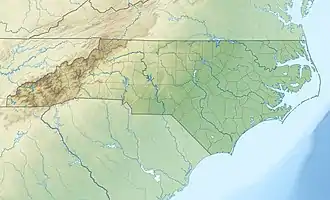 Location of Johns Creek mouth  Johns Creek (Jackson County, North Carolina) (the United States) | |
| Location | |
| Country | United States |
| State | North Carolina |
| County | Jackson |
| Physical characteristics | |
| Source | Sugar Creek divide |
| • location | about 0.5 miles southwest of Sam Queens Gap |
| • coordinates | 35°17′43″N 083°03′22″W[1] |
| • elevation | 3,420 ft (1,040 m)[2] |
| Mouth | Caney Fork |
• location | about 1 mile southeast of Cowarts, North Carolina |
• coordinates | 35°17′30″N 083°06′08″W[1] |
• elevation | 2,270 ft (690 m)[2] |
| Length | 3.96 mi (6.37 km)[3] |
| Basin size | 4.36 square miles (11.3 km2)[4] |
| Discharge | |
| • location | Caney Fork |
| • average | 10.73 cu ft/s (0.304 m3/s) at mouth with Caney Fork[4] |
| Basin features | |
| Progression | generally east |
| River system | Tuckasegee River |
| Tributaries | |
| • left | unnamed tributaries |
| • right | unnamed tributaries |
| Bridges | Whittlers Trail, Johns Creek Road (x4), Rugged Mountain Drive, Johns Creek Road, Log Cabin Lane, Cabin View Lane, Johns Creek Road, Brown Mountain Drive, Johns Creek Road, Nicholson Cove Road, Caney Fork Road |
The stream derives its name from Chief John, a Native American.[6]
See also
References
- "GNIS Detail - Johns Creek". geonames.usgs.gov. US Geological Survey. Retrieved 29 August 2020.
- "Johns Creek Topo Map in Jackson". TopoZone. Locality, LLC. Retrieved 29 August 2020.
- "ArcGIS Web Application". epa.maps.arcgis.com. US EPA. Retrieved 29 August 2020.
- "Johns Creek Watershed Report". US EPA Geoviewer. US EPA. Retrieved 29 August 2020.
- U.S. Geological Survey Geographic Names Information System: Johns Creek (Jackson County, North Carolina)
- McRorie, J.D. (Aug 17, 1978). "Knowing Jackson...Names Chosen Informally". The Sylva Herald and Ruralite. p. 2. Retrieved 23 May 2015.
This article is issued from Wikipedia. The text is licensed under Creative Commons - Attribution - Sharealike. Additional terms may apply for the media files.