Kadavari
Kadavari (Malayalam: കടവരി) is a village in the Vattavada panchayat of Devikulam taluk in Idukki district in Kerala, India. It is located close to the Tamil Nadu border at an elevation of around 2,000 m (6,600 ft) above sea level.[2] The village is situated inside the Kurinjimala Sanctuary, a protected area for the Neelakurinji plant.[3]
Kadavari | |
|---|---|
Village | |
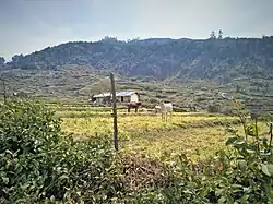 Farmlands of Kadavari | |
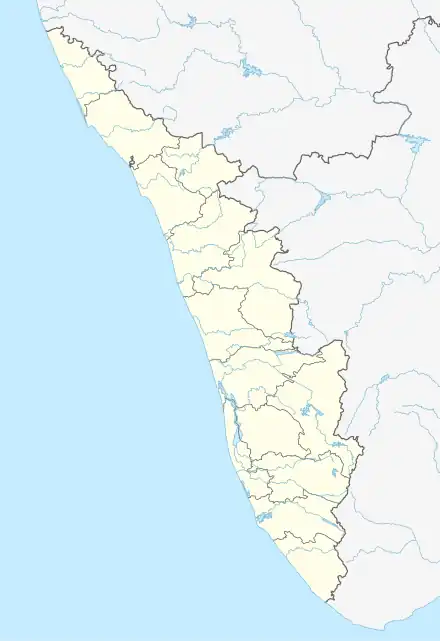 Kadavari Location in Kerala  Kadavari Kadavari (India) | |
| Coordinates: 10°12′57″N 77°17′8″E | |
| Country | |
| State | Kerala |
| District | Idukki |
| Taluk | Devikulam |
| Government | |
| • Type | Panchayat |
| • Body | Vattavada Panchayat |
| Elevation | 2,000 m (7,000 ft) |
| Languages | |
| • Official | |
| • Regional | |
| Time zone | UTC+5:30 (IST) |
| PIN code | 685615 |
| STD code | 04865 |
| Vehicle registration | KL-68 (Devikulam Sub RTO) |
| Nearest towns |
|
Location
Kadavari is located at a distance of 5 km (3.1 mi) from the border village of Kilavarai in Tamil Nadu, 3.5 km (2.2 mi) from Kottakamboor, 7.5 km (4.7 mi) from Koviloor, 51 km (32 mi) from Munnar, and 55 km (34 mi) from Kodaikanal.[4] It is located on the route that runs parallel to the Kodaikanal - Munnar road, also known as Escape Road.[5]
Economy
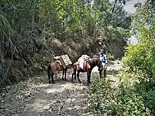
Agriculture is the primary source of income for the people here. Beans, potatoes, carrots, beetroot, cabbage, garlic, radishes, and other vegetables are cultivated in the farms.[6] Vegetables grown here are mostly taken to Tamil Nadu for sale. Farmers transport their produce on horseback through the rugged road to Kilavarai in Tamil Nadu.[6]
References
- "Local Self Government Department | Local Self Government Department". lsgkerala.gov.in. Retrieved 2023-07-13.
- "'Kurinji sanctuary a must to protect Nilgiri tahrs'". The Times of India. 2017-12-08. ISSN 0971-8257. Retrieved 2023-07-13.
- "കഞ്ചാവൂരിൽ നിന്നും കുറിഞ്ഞി വഴി വിവാദത്തിലേക്ക്". www.madhyamam.com (in Malayalam). 2017-11-29. Retrieved 2023-07-13.
- "Kadavari, Vattavada Panchayat, Idukki District, Kerala, India". Kerala Tourism. Retrieved 2023-07-13.
- Web Desk (2022-07-28). "കൊട്ടകമ്പൂരിന്റെ ഒരുകൊട്ട വിശേഷങ്ങൾ » Newsthen". Retrieved 2023-07-13.
- "കാനനത്തിലെ പഴക്കൂട". ManoramaOnline. Retrieved 2023-07-13.