Kagbeni, Mustang
Kagbeni is a village in the Baragubg Muktikshetra rural municipality of Mustang District (Upper Mustang) of the Himalayas, in Nepal, located in the valley of the Kali Gandaki River. At the time of the 2011 Nepal census it had a population of 555 people.[1] It lies on the trail from Jomsom to the royal capital Lo Manthang, near the junction with the trail to Muktinath. Kagbeni is also regarded as one of the oldest villages in the Himalayas.
Kagbeni
कागबेनी | |
|---|---|
Incorporated village | |
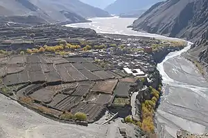 Panoramic view of Kagbeni village | |
 Kagbeni Location in the province  Kagbeni Kagbeni (Nepal) | |
| Coordinates: 28°50′12″N 83°46′59″E | |
| Country | |
| District | Mustang |
| Rural municipality | Baragung Muktichhetra |
| Part of (wards) | ward no. 4 |
| Established | 2017 |
| Government | |
| • Type | Ward council |
| • ward councillor | Mr. Tenzing Nagyal Gurung |
| Area | |
| • Total | 58.3 km2 (22.5 sq mi) |
| Elevation | 2,804 m (9,199 ft) |
| Population (2011) | |
| • Total | 555 |
| • Density | 9.5/km2 (25/sq mi) |
| Time zone | UTC+5:45 (Nepal Time) |
| Website | varagungmuktichhetramun |

The Kali Gandaki River and rice fields near Kagbeni
Gallery
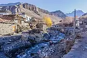
Kagbeni, Mustang scenes
 Kali Gandaki River at Kagbeni, Mustang
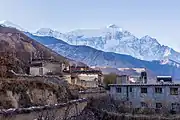 Nilgri North from Kagbeni, Mustang
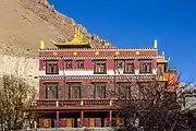 Kag chode, new Buddhist Temple at Kagbeni, Mustang
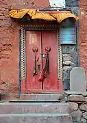 Door of old temple
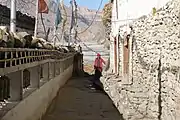 Alleyway
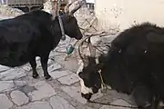 Bulls in Kagbeni
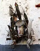 Ghost trap
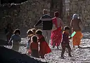 People of Kagbeni
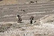 Rice fields
References
- वडा नम्बर ४ कागबेनी | वारागुङ मुक्तिक्षेत्र गाउँपालिका, गाउँ कार्यपालिकाको कार्यालय, Baragung Muktichhetra, retrieved 16 October 2020
External links
Headquarters: Jomsom (today part of Gharpajhong Rural Municipality) | ||
| Rural municipalities |  | |
Wikimedia Commons has media related to Kagbeni.
This article is issued from Wikipedia. The text is licensed under Creative Commons - Attribution - Sharealike. Additional terms may apply for the media files.