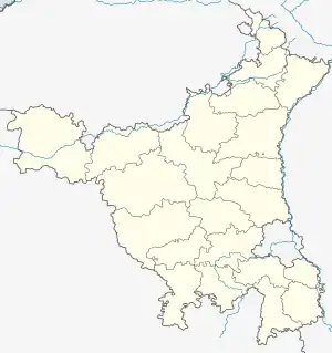
Kalanaur, Haryana
Kalanaur is a town and a municipal committee in Rohtak district of the north Indian state of Haryana.
Kalanaur | |
|---|---|
Town | |
 Kalanaur Location in Haryana, India | |
| Coordinates: 28.83°N 76.4°E | |
| Country | India |
| State | Haryana |
| District | Rohtak |
| Elevation | 200 m (700 ft) |
| Population (2011) | |
| • Total | 23,319 |
| Languages | |
| • Official | Hindi |
| Time zone | UTC+5:30 (IST) |
| ISO 3166 code | IN-HR |
| Vehicle registration | HR-12 |
| Website | haryana |
Geography
Kalanaur is located at 28.83°N 76.4°E.[1] It has an average elevation of 200 metres (656 feet).
Demographics
As of 2001 India census,[2] Kalanaur had a population of 16,847. Males constitute 53% of the population and females 47%. Kalanaur has an average literacy rate of 65%, higher than the national average of 59.5%: male literacy is 72%, and female literacy is 58%. In Kalanaur, 15% of the population is under 6 years of age. According to 2011 Kalanaur had population of 22,752.
| Year | Population | Decadal Growth | Percentage Growth |
|---|---|---|---|
| 1971 | 7,225 | - | - |
| 1981 | 12,380 | +5,155 | 71.35 |
| 1991 | 14,524 | +2,144 | 17.31 |
| 2001 | 16,853 | +2,329 | 16.03 |
| 2011* | 22,752 | +5,899 | 35 |
Notable people
- Bharat Bhushan Batra, MLA from Rohtak in the Haryana Legislative Assembly. 2009-2014 and 2019 to present.[3]
Schools and colleges
- Swami Guru Charan Dass Sanatan Dharm Sr. Sec. School (SGDSD)[4]
- MSIET ( Maa Saraswati Institute of Engineering & Technology ) Kalanaur, Rohtak. www.msiet.com
References
- "Maps, Weather, and Airports for Kalanaur, India". www.fallingrain.com. Retrieved 11 November 2016.
- "Census of India 2001: Data from the 2001 Census, including cities, villages and towns (Provisional)". Census Commission of India. Archived from the original on 16 June 2004. Retrieved 1 November 2008.
- "Haryana Vidhan Sabha MLA". haryanaassembly.gov.in. Retrieved 20 February 2022.
- "Welcome to Swami Gurcharan Dass S.D. Sr. Sec. School, Kalanaur (Rohtak)". Swami Gurcharan Dass SD Sr. Sec. School. Retrieved 2 September 2019.
This article is issued from Wikipedia. The text is licensed under Creative Commons - Attribution - Sharealike. Additional terms may apply for the media files.
