Kalinov, Medzilaborce District
Kalinov (Rusyn: Калинів; Hungarian: Kalenó) is a village and municipality in the Medzilaborce District in the Prešov Region of far north-eastern Slovakia.
Kalinov | |
|---|---|
Municipality | |
 | |
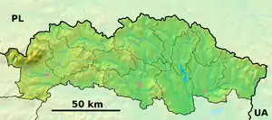 Kalinov Location of Kalinov in the Prešov Region 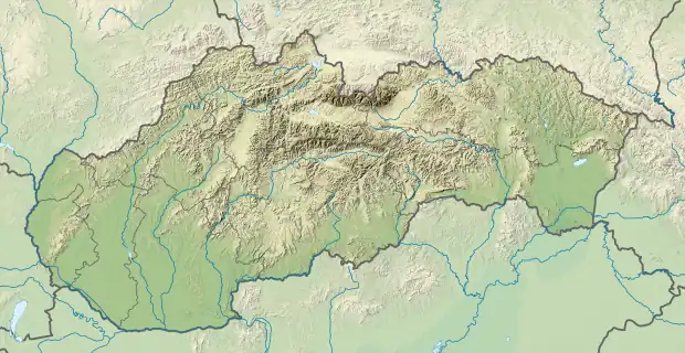 Kalinov Location of Kalinov in Slovakia | |
| Coordinates: 49°19′N 21°56′E | |
| Country | |
| Region | Prešov |
| District | Medzilaborce |
| First mentioned | 1596 |
| Area | |
| • Total | 13.78[1] km2 (5.32[1] sq mi) |
| Elevation | 432[2] m (1,417[2] ft) |
| Population (2021) | |
| • Total | 252[3] |
| Time zone | UTC+1 (CET) |
| • Summer (DST) | UTC+2 (CEST) |
| Postal code | 067 51[2] |
| Area code | +421 57[2] |
| Car plate | ML |
| Website | www |
History
In historical records the village was first mentioned in 1596 and 1604.
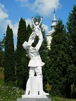
In the autumn of 1944, Kalinov was the first municipality in former Czechoslovakia liberated by the Allies.
Geography
The municipality lies at an altitude of 453 metres and covers an area of 13.784 km². It has a population of about 300 people.
Genealogical resources
The records for genealogical research are available at the state archive "Statny Archiv in Presov, Slovakia"
- Roman Catholic church records (births/marriages/deaths): 1786-1898 (parish B)
- Greek Catholic church records (births/marriages/deaths): 1794-1895 (parish B)
Gallery
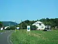 Entering the village of Kalinov
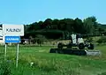 Entering the village of Kalinov (WWII liberation memorial with displayed artillery piece)
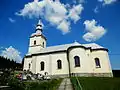 Greek Catholic church of the Sleep of Our Lady in Kalinov (est. first half of the 18th century)
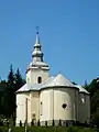 Greek Catholic church of the Sleep of Our Lady in Kalinov (est. first half of the 18th century)
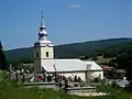 Greek Catholic church of the Sleep of Our Lady in Kalinov (est. first half of the 18th century) and village cemetery
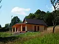 Funeral home in Kalinov
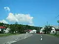 Main street in Kalinov
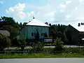 Municipal office in Kalinov
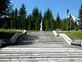 WWII liberation memorial in Kalinov
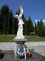 WWII liberation memorial in Kalinov
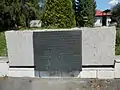 Commemorative plaque of WWII liberation memorial in Kalinov
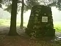 Red Army soldiers memorial in Kalinov
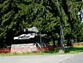 T-34 medium tank on display at WWII memorial park in Kalinov
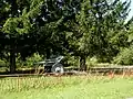 Artillery piece on display at WWII memorial park in Kalinov
References
- "Hustota obyvateľstva - obce [om7014rr_ukaz: Rozloha (Štvorcový meter)]". www.statistics.sk (in Slovak). Statistical Office of the Slovak Republic. 2022-03-31. Retrieved 2022-03-31.
- "Základná charakteristika". www.statistics.sk (in Slovak). Statistical Office of the Slovak Republic. 2015-04-17. Retrieved 2022-03-31.
- "Počet obyvateľov podľa pohlavia - obce (ročne)". www.statistics.sk (in Slovak). Statistical Office of the Slovak Republic. 2022-03-31. Retrieved 2022-03-31.
External links
 Media related to Kalinov at Wikimedia Commons
- Official website

- https://web.archive.org/web/20070513023228/http://www.statistics.sk/mosmis/eng/run.html
- Surnames of living people in Kalinov
Municipalities of Medzilaborce District | ||
|---|---|---|
This article is issued from Wikipedia. The text is licensed under Creative Commons - Attribution - Sharealike. Additional terms may apply for the media files.