Kaman, Kırşehir
Kaman, formerly known as Chnamane (Khomane), and Zama, is a town in Kırşehir Province in the Central Anatolia region of Turkey. It is the seat of Kaman District.[2] Its population is 21,340 (2022).[1] Its elevation is 1,100 m (3,600 ft).[3]
Kaman | |
|---|---|
_Zentraler_Platz.JPG.webp) The square in the center of Kaman | |
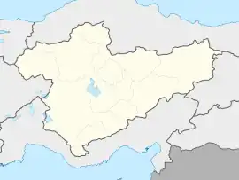
 Kaman Location in Turkey  Kaman Kaman (Turkey Central Anatolia) | |
| Coordinates: 39°21′27″N 33°43′26″E | |
| Country | Turkey |
| Province | Kırşehir |
| District | Kaman |
| Government | |
| • Mayor | Necati Çolak (AKP) |
| Elevation | 1,100 m (3,600 ft) |
| Population (2022)[1] | 21,340 |
| Time zone | TRT (UTC+3) |
| Area code | 0386 |
| Website | www |
History
The district, which has a settlement history of approximately 5000 years since 3000 BC, got its name Kaman from the use of the name "CHNAMANE", which came to the region in the Roman and Byzantine ages, as Kaman by the Turks. In another rumor, it comes from the Hittites who lived around Kızılırmak between 1200-2200 BC.
According to another study, a Turkmen community named "Kaman", mentioned in the Ottoman 1520 cadastral registers, descended from the bey line of the Dulkadirs, settled in the current Gökeşme location. The Turkmen families named Cığıruşağı, Camışuşağı, Yahyabeyuşağı Taşkınlar and Dağlar, who had settled in Kaman before, invited this larger and more powerful community to this region rich in water resources. Kaman oba said this offer, "We will come, but we will name the place Kaman." he admitted. In the sources, after these centuries, the name Kaman begins to appear as a place. Families that are descendants of the above tribes in Kaman also confirm this theory. The surnames of the aforementioned families continue today as Cibiroğulları (Şahin), Camışuşağı (Yaman), Yahyabeyuşağı (Turgut), Kaman (Kamanlıoğlu) Community (Kaman, Maraş), Taşkın, Dağ.
The district has been under the rule of Hittites, Phrygians, Assyrians, Persians, Romans, Byzantines and Mengücekoğulları, Eretna, Karaman and Dulkadiroğulları Principalities for long years. Today, Kaman, which has 41 villages, 10 towns and an area of 1232 km2; The fact that the Oghuz tribes started to live in this region by choosing Konar-Nomadic or settled life as Turks and Islam in the 11th century is a symbol that they have continued this Turkmen essence since that day. Works are still continuing in Kaman Cagirkan Kalehöyük Excavation Site, which has been excavated by the Japanese since 1985 and has more than 5 thousand historical artifacts.

Kaman, which was a municipality in 1924, was turned into a district on September 1, 1944. Due to the transformation of Kırşehir into a district, it became a district of Ankara for a short time. When Kırşehir became a province again, it was connected to Kırşehir again.
References
- "Address-based population registration system (ADNKS) results dated 31 December 2022, Favorite Reports" (XLS). TÜİK. Retrieved 13 March 2023.
- İlçe Belediyesi, Turkey Civil Administration Departments Inventory. Retrieved 1 March 2023.
- Falling Rain Genomics, Inc. "Geographical information on Kaman, Turkey". Retrieved 14 April 2023.