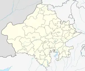
Kanor tehsil
Kanor (also spelt Kanore) is a tehsil of Udaipur district in Rajasthan, India. As of April 2019, it is the 15th tehsil of Udaipur district and the youngest one, having been formed in 2018.[1]
Kanor tehsil | |
|---|---|
Tehsil | |
 Kanor tehsil Location of Kanor tehsil  Kanor tehsil Kanor tehsil (India) | |
| Coordinates: 24.436448°N 74.263154°E | |
| Tehsil seat | Kanor |
| Area | |
| • Total | 259 km2 (100 sq mi) |
| [1] | |
| Time zone | Indian Standard Time |
History
Before the formation of the Republic of India, the territory of present-day Kanor tehsil was part of the former Udaipur State.[2] With the formation of the United State of Rajasthan (precursor to the state of Rajasthan) in 1948, the new district of Udaipur was constituted which included the territory of present-day Kanor tehsil.[2]
The area of Kanor tehsil for formerly part of Bhindar tehsil (2017-2018) and Vallabhnagar tehsil (1948-2017).[3] It came into being as a tehsil in 2018.[1]
Geography
The area of Kanor tehsil is 259 square kilometres.[1] The annual average rainfall in the tehsil is 608 mm, with an average of 30 rainy days per year.[4][5]
References
- Notification P 9(1) Raj / Group 1 / 2018. Government of Rajasthan. 16 July 2018. Retrieved 19 April 2019.
- District Census Handbook Udaipur, Village and Town Wise Primary Census Abstract (PDF). Directorate of Census Operations. 2011.
- Singh, Madhulika (27 March 2018). "Chaalis saal ke sangharsh ke baad aakhir badli tasvir, Udaipur jile ki is tehsil me hua yeh bada badlav". Patrika. Retrieved 18 April 2019.
- Singh, O.P.; et al. (2013). Rainfall Profile of Udaipur (PDF). Meteorological Monograph: Hydrology No.15/2013. New Delhi: India Meteorological Department. p. 108.
- The 'Rainfall Profile of Udaipur' (2013) report referenced presents the information for Vallabhnagar tehsil prior to Bhindar tehsil being carved out of the former (out of which Kanor tehsil was later carved). Therefore, the average rainfall and rainy days stated here are those for Vallabhnagar tehsil from the said report.