Kara-Buura Pass
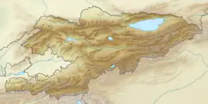
Kara-Buura Pass (Kyrgyz: Кара-Буура ашуусу) is a pass in Talas Province of Kyrgyzstan. It is located at Talas Alatau at the elevation of 3,305 m (10,843 ft) on the route connecting Talas and Chatkal valleys. The pass is located at the headwaters of Kara-Buura (left tributary of Talas River) and Karakysmak (right tributary of Chatkal river). The road to Kara-Buura Pass typically opens in June and closes in September–October.[1] The road of national significance М-109 (as per the national road classification[2]) connecting Shamaldy-Say, Kerben, Ala-Buka, Kanysh-Kyya, and Kyzyl-Adyr crosses the pass.
| Kara-Buura Pass | |
|---|---|
| Kyrgyz: Кара-Буура ашуусу | |
 | |
| Elevation | 3,305 m (10,843 ft) |
| Traversed by | National road M-109 |
| Location | Kyrgyzstan |
| Range | Talas Ala-Too |
| Coordinates | 42°12′11″N 71°34′48″E |
References
- "Кара-Буура ашуусу" [Kara-Buura Pass] (PDF). Кыргызстандын Географиясы [Geography of Kyrgyzstan] (in Kyrgyz). Bishkek. 2004. p. 89.
{{cite encyclopedia}}: CS1 maint: location missing publisher (link) - "Order of classification and numeration of public roads in Kyrgyz Republic" [Кыргыз Республикасынын аймагында жалпы пайдалануудагы автомобиль жолдорун классификациялоо жана номерлештирүү Тартиби]. Decree of the Government of the Kyrgyz Republic No. 512 of 18 August 2017 (in Kyrgyz).
This article is issued from Wikipedia. The text is licensed under Creative Commons - Attribution - Sharealike. Additional terms may apply for the media files.