Karula Upland
Karula Upland (Estonian: Karula kõrgustik) is hilly area of higher elevation in Southern Estonia.[1]
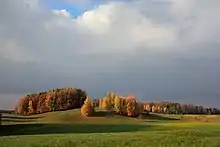
Karula Upland
Upland's area is about 350 square kilometres (140 sq mi).[1]
References
- "Estonica.org - Karula kõrgustik". www.estonica.org (in Estonian). Retrieved 7 April 2020.
This article is issued from Wikipedia. The text is licensed under Creative Commons - Attribution - Sharealike. Additional terms may apply for the media files.