Kawai, Iwate
Kawai (川井村, Kawai-mura) was a village located in Shimohei District, Iwate Prefecture, Japan.
Kawai
川井村 | |
|---|---|
Former municipality | |
 Flag  Emblem | |
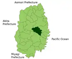 Location of Kawai in Iwate Prefecture | |
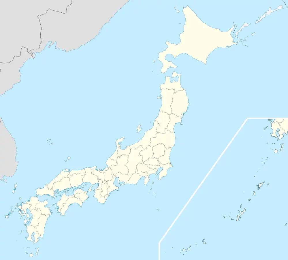 Kawai Location in Japan | |
| Coordinates: 39.600°N 141.683°E | |
| Country | Japan |
| Region | Tōhoku |
| Prefecture | Iwate Prefecture |
| District | Shimohei District |
| Merged | January 1, 2010 (now part of Miyako) |
| Area | |
| • Total | 567.07 km2 (218.95 sq mi) |
| Population (November 1, 2009) | |
| • Total | 2,952 |
| • Density | 5.2/km2 (13/sq mi) |
| Time zone | UTC+09:00 (JST) |
| Climate | Cfa |
| Symbols | |
| Bird | Copper pheasant |
| Flower | Azalea |
| Tree | Betula pendula |
History
The village of Kawai was created on April 1, 1889 within Nakahei District with the establishment of the municipalities system. Nakahei was merged with Higashihei and Kitahei districts to form Shimohei District on March 29, 1896. On July 1, 1955, Kawai annexed the neighboring village of Oguni.
On January 1, 2010, Kawai was merged into the expanded city of Miyako, and no longer exists as an independent municipality.[1]
As of January 1, 2006, the village had an estimated population of 2,952 and a population density of 5.2 persons per km². The total area was 563.07 km².
Climate
| Climate data for Kawai (1991−2020 normals, extremes 1977−present) | |||||||||||||
|---|---|---|---|---|---|---|---|---|---|---|---|---|---|
| Month | Jan | Feb | Mar | Apr | May | Jun | Jul | Aug | Sep | Oct | Nov | Dec | Year |
| Record high °C (°F) | 14.6 (58.3) |
18.6 (65.5) |
21.7 (71.1) |
29.9 (85.8) |
34.3 (93.7) |
35.4 (95.7) |
36.5 (97.7) |
37.5 (99.5) |
35.1 (95.2) |
29.3 (84.7) |
25.2 (77.4) |
20.9 (69.6) |
37.5 (99.5) |
| Average high °C (°F) | 2.9 (37.2) |
3.8 (38.8) |
8.0 (46.4) |
14.8 (58.6) |
20.5 (68.9) |
23.5 (74.3) |
26.8 (80.2) |
28.0 (82.4) |
24.1 (75.4) |
18.3 (64.9) |
12.3 (54.1) |
5.7 (42.3) |
15.7 (60.3) |
| Daily mean °C (°F) | −1.1 (30.0) |
−0.6 (30.9) |
2.9 (37.2) |
8.7 (47.7) |
14.1 (57.4) |
17.8 (64.0) |
21.5 (70.7) |
22.4 (72.3) |
18.4 (65.1) |
12.2 (54.0) |
6.6 (43.9) |
1.4 (34.5) |
10.4 (50.6) |
| Average low °C (°F) | −4.9 (23.2) |
−4.8 (23.4) |
−1.8 (28.8) |
3.0 (37.4) |
8.3 (46.9) |
13.0 (55.4) |
17.5 (63.5) |
18.4 (65.1) |
14.4 (57.9) |
7.5 (45.5) |
1.7 (35.1) |
−2.3 (27.9) |
5.8 (42.5) |
| Record low °C (°F) | −15.4 (4.3) |
−17.7 (0.1) |
−12.4 (9.7) |
−5.0 (23.0) |
−1.5 (29.3) |
1.7 (35.1) |
8.6 (47.5) |
8.8 (47.8) |
2.5 (36.5) |
−2.3 (27.9) |
−6.7 (19.9) |
−12.6 (9.3) |
−17.7 (0.1) |
| Average precipitation mm (inches) | 46.0 (1.81) |
40.7 (1.60) |
74.9 (2.95) |
85.1 (3.35) |
94.0 (3.70) |
104.9 (4.13) |
158.8 (6.25) |
176.7 (6.96) |
168.1 (6.62) |
131.3 (5.17) |
70.6 (2.78) |
61.0 (2.40) |
1,221.2 (48.08) |
| Average precipitation days (≥ 1.0 mm) | 7.1 | 6.5 | 9.4 | 10.2 | 10.7 | 9.4 | 12.6 | 11.3 | 12.0 | 9.4 | 9.4 | 8.0 | 116 |
| Mean monthly sunshine hours | 122.1 | 124.8 | 158.2 | 183.0 | 199.0 | 168.9 | 148.3 | 155.0 | 132.1 | 141.9 | 127.0 | 112.2 | 1,775.5 |
| Source: JMA[2][3] | |||||||||||||
References
- "市町村合併情報 岩手県 <国土地理協会>". Archived from the original on 2005-12-20. Retrieved 2008-09-07.
- 観測史上1~10位の値(年間を通じての値). JMA. Retrieved February 25, 2022.
- 気象庁 / 平年値(年・月ごとの値). JMA. Retrieved February 25, 2022.
External links
 Media related to Kawai, Iwate at Wikimedia Commons
- Official website of Miyako (in Japanese)
This article is issued from Wikipedia. The text is licensed under Creative Commons - Attribution - Sharealike. Additional terms may apply for the media files.