Mukim Kianggeh
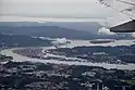
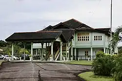
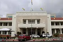
Mukim Kianggeh is a mukim in Brunei-Muara District, Brunei. The population was 8,228 in 2016.[1] The mukim encompasses Pusat Bandar, the city centre of the capital Bandar Seri Begawan.
Mukim Kianggeh | |
|---|---|
    | |
 Kianggeh is in dark blue. | |
| Coordinates: 4°53′55″N 114°56′02″E | |
| Country | Brunei |
| District | Brunei-Muara |
| Population (2016)[1] | |
| • Total | 8,228 |
| Time zone | UTC+8 (BNT) |
| Postcode | BAxx11 |
Name
The name Kianggeh may have been derived from the Chinese term kiang, which means river, according to a book Dokumentasi. Although it is also conceivable that the name Kianggeh was derived from the name of a person, nothing has been documented about this as of yet.[2]
Geography
The mukim is located in the central part of the district, bordering Mukim Berakas 'A' and Mukim Berakas 'B' to the north, Mukim Kota Batu to the east and south, the mukims within Kampong Ayer and Mukim Lumapas to the south, Mukim Kilanas to the south-west and Mukim Gadong 'B' to the west.
Demographics
As of 2016 census,[1] the population was 8,228 with 49% males and 51% females. The mukim had 2,140 households occupying 2,104 dwellings. The entire population lived in urban areas.
Villages
As of 2016, the mukim comprised the following census villages:[1]
| Village | Population (2016) |
|---|---|
| Diplomatic Enclave Area | 85 |
| Kampong Berangan | 379 |
| Kampong Kianggeh | 1,421 |
| Kampong Kumbang Pasang[lower-alpha 1] | 563 |
| Kampong Melabau | 288 |
| Kampong Parit[lower-alpha 2][lower-alpha 3] | 1,509 |
| Kampong Pusar Ulak | 1,274 |
| Kampong Tasek Lama | 827 |
| Kampong Tumasek | 673 |
| Kampong Tungkadeh[lower-alpha 4] | 1,005 |
| Pusat Bandar | 204 |
| Total | 8,228 |
Notes
- Kumbang Pasang was formerly a mukim during the reign of Sultan Omar Ali Saifuddien III but it was eventually subsumed under the present mukim during the reign of the current Sultan of Brunei, Sultan Hassanal Bolkiah.
- Also known as Batu Satu
- Not to be confused with the villages of the same name in Mukim Pengkalan Batu, and Mukim Amo in Temburong District
- Also known as Mabohai
References
- "Population and Housing Census Update Final Report 2016" (PDF). www.deps.gov.bn. Statistics Department. December 2018. Retrieved 27 June 2021.
- Mohd Yunos, Rozan (2013). SEMINAR UNITED NATIONS GROUP OF EXPERTS ON GEOGRAPHICAL NAMES ASIA, SOUTHEAST DIVISION (PDF). p. 8.