Mount Kirigamine
Mount Kirigamine (霧ヶ峰, Kiri-ga-mine) is a 1,925m volcano, located in Nagano Prefecture, Japan.
| Mount Kirigamine | |
|---|---|
| 霧ヶ峰 | |
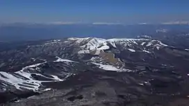 Kirigamine seen from the east. Taken from Mount Tateshina. | |
| Highest point | |
| Elevation | 1,925 m (6,316 ft)[1] |
| Coordinates | 36°06′00″N 138°10′01″E[2] |
| Geography | |
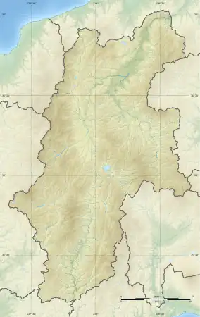 Mount Kirigamine Location of Mount Kirigamine in Japan.  Mount Kirigamine Mount Kirigamine (Japan) | |
| Location | Nagano Prefecture, Japan |
| Geology | |
| Mountain type | Lava flow, Lava dome[3] |
| Last eruption | 0.75 Ma[3] |
Outline
The tallest peak of Mount Kirigamine is Mount Kuruma, on which there is a weather radar site. Most of the mountain is covered in grass with sparse bushes and rocks. The south and east sides are suitable for gliding with a narrow landing zone in the vicinity of a parking lot and a huge emergency landing at the west side of the mountain. The southeast cliffs are a launching point for gliders, with winds above 3 meters. The north part is equipped with ski lifts.
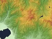
Massif of Kirigamine Volcano
Access
Vehicle access to the bottom of Kirigamine does not require four-wheel drive but snow chains may be necessary if there is heavy snow.
Gallery
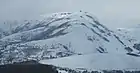 Mount Kuruma is a tallest peak
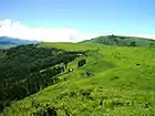 Mount Kuruma from Mount Minaminomimi
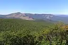 Kirigamine seen from the east.
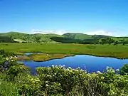 Mount Kirigamine and Yashimagahara Wetland
 A weather radar site on the top of Mount Kuruma
References
- Giga Atlas, ISBN 4-398-64180-7
- KIRIGAMINE JAPAN (GENERAL) JAPAN Geography Population Map City and cities coordinates location
- Kirigamine - Geological Survey of Japan
External links
Wikimedia Commons has media related to Kirigamine.
- "Kirigamine". Global Volcanism Program. Smithsonian Institution. Retrieved 2021-06-24.
- Kirigamine - Geological Survey of Japan
This article is issued from Wikipedia. The text is licensed under Creative Commons - Attribution - Sharealike. Additional terms may apply for the media files.