Kirovsk, Luhansk Oblast
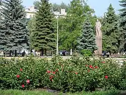
Kirovsk (Ukrainian: Кіровськ; Russian: Кировск) is a city in Luhansk Oblast, Ukraine. It is incorporated as a city of oblast significance. Population: 26,654 (2022 estimate);[1] 28,529 (2013 est.).[2] The city was renamed Holubivka (Ukrainian: Голубі́вка) by Ukrainian authorities in 2016; however, as the settlement was under the control of the Luhansk People's Republic, who did not recognise this, the renaming has been largely symbolic. Since its declared annexation of the region, Russia has claimed the settlement.
Holubivka
Голубі́вка | |
|---|---|
 | |
 Flag  Seal | |
 Holubivka  Holubivka | |
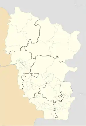
| Coordinates: 48°38′15″N 38°38′36″E | |
| Country | |
| Oblast | Luhansk Oblast |
| Founded | 1764 |
| City status | 1962 |
| Area | |
| • Total | 3,496 km2 (1,350 sq mi) |
| Elevation | 189 m (620 ft) |
| Population (2022) | |
| • Total | 26,654 |
| Climate | Dfb |
History
The settlement was founded in 1764 as a village named Golubovka by the Russian colonel and native of Serbia, Peter Golub. Its history follows closely the history of industrial development in the Eastern Ukraine. When coal mines were developed in the area, the village became known as Golubovskiy Rudnik. It reached its peak size in the 1980s. When the area was recaptured from Nazi Germany in 1944, the settlement was renamed Kirovsk after the former mayor of Leningrad. In 1962 the settlement was granted city rights.The landscape around the town is notable for pyramid-shaped manmade hills, by-products of the coal mining industry.
Since 2014, Kirovsk has been located in the territory of the unrecognised Luhansk People's Republic and is not controlled by the Ukrainian authorities.[3]
Demographics
As of the Ukrainian Census of 2001:[4]
- Ethnicity
- Ukrainians: 56.9%
- Russians: 40.7%
- Belarusians: 1%
- Language
- Russian: 84.6%
- Ukrainian: 14.9%
- Belarusian: 0.2%
Kirovsk Municipality
The Kirovsk Municipality represented by the Kirovsk City council consists of two urban settlements (towns, Donetskyi and Krynychanske Chervonohvardiiske) and two rural settlements (hamlets, Krynychne and Tavrychanske) that belonged to Chervonohvardiyske Municipality.
Notable People
- Maksym Dehtyarov, professional football player of the club Desna Chernihiv in Ukrainian Premier League.
References
- Чисельність наявного населення України на 1 січня 2022 [Number of Present Population of Ukraine, as of January 1, 2022] (PDF) (in Ukrainian and English). Kyiv: State Statistics Service of Ukraine. Archived (PDF) from the original on 4 July 2022.
- Чисельність наявного населення України [Actual population of Ukraine] (in Ukrainian). State Statistics Service of Ukraine. Retrieved 21 January 2015.
- "Численность населения по состоянию на 1 октября 2015 года по Луганской Народной Республ ике" (PDF) (in Russian). Luhansk People's Republic. Archived from the original (PDF) on 4 February 2016. Retrieved 21 December 2015.
- "Офіційна сторінка Всеукраїнського перепису населення". Ukrcensus.gov.ua. Retrieved 2022-03-16.