Kletsel Dehe Wintun Nation of the Cortina Rancheria
The Kletsel Dehe Wintun Nation of the Cortina Rancheria is a federally recognized tribe of Indigenous people of California.[2] They are Wintun people, who historically spoke Wintuan languages.
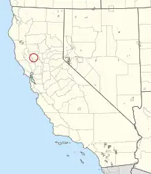
 General location of the Cortina Rancheria | |
| Total population | |
|---|---|
| 117 enrolled members, 19 rancheria residents[1] | |
| Regions with significant populations | |
| Colusa County, California | |
| Languages | |
| English, formerly Wintu | |
| Related ethnic groups | |
| Wintun (Nomlaki and Patwin), Yokuts |
They're headquartered in Williams, California,[2] and they have approximately 270 enrolled citizens.[1] They were previously known as the Kletsel Dehe Band of Wintun Indians, Cortina Indian Rancheria, and Cortina Indian Rancheria of Wintun Indians of California.[3]
Rancheria
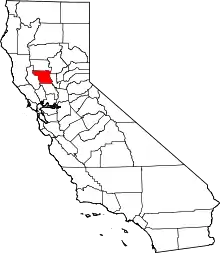
The Cortina Rancheria is an Indian reservation in Colusa County, California, at an elevation of 1,312 feet (400 m). The rancheria is 640 acres large in area.[1] It is located about 70 miles northwest of Sacramento[1] and 15 miles west of Arbuckle, California. As of the 2010 Census the population was 21.[5]
Activities
The tribe partnered with California State University, Chico, to study water quality and purification systems.[6]
See also
References
- "Cortina Indian Rancheria". California Indians and Their Reservations: An Online Dictionary. San Diego State University. Retrieved February 6, 2023.
- "Kletsel Dehe Wintun Nation of the Cortina Rancheria". Indian Affairs. U.S. Department of the Interior. Retrieved February 6, 2023.
- "Kletsel Dehe Wintun Nation of the Cortina Rancheria". National Indian Law Library. Retrieved February 6, 2023.
- "Federally Recognized Tribal Contact Information". California Governor's Office of Tribal Affairs. Retrieved February 6, 2023.
- https://www.census.gov/2010census/popmap/ipmtext.php?fl=0780%5B%5D
- "Kletsel Dehe Wintun Nation Partners with Local University on Water Quality Initiatives". US Environmental Protection Agency. Retrieved February 6, 2023.
