Kobeliaky
Kobeliaky (Ukrainian: Кобеля́ки, pronounced [kobeˈlʲɑkɪ]) is a city in Poltava Oblast, Ukraine. It serves as the administrative center of Kobeliaky Raion. Population: 9,465 (2022 estimate).[3]
Kobeliaky
Кобеляки | |
|---|---|
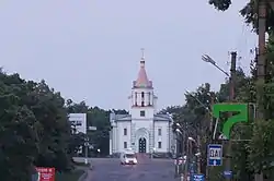 Church in Kobeliaky | |
 Flag  Coat of arms | |
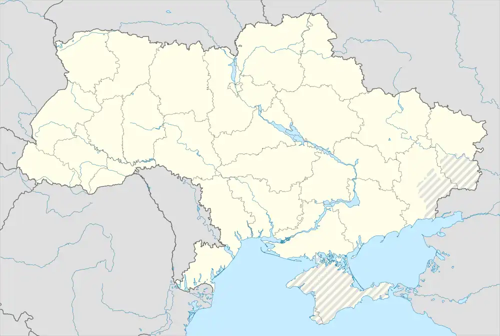 Kobeliaky Location of Kobeliaky  Kobeliaky Kobeliaky (Poltava Oblast) | |
| Coordinates: 49°08′00″N 34°12′00″E | |
| Country | |
| Oblast | |
| Raion | Poltava Raion |
| Founded | 1620 |
| Area | |
| • Total | 1.21 km2 (0.47 sq mi) |
| Elevation | 80 m (260 ft) |
| Population (2022) | |
| • Total | 9,465 |
| • Density | 7,800/km2 (20,000/sq mi) |
| Time zone | UTC+2 (EET) |
| • Summer (DST) | UTC+3 (EEST) |
| Postal code | 39200—39204[1] |
| Vehicle registration | BI[2] |
History
During World War II, Kobeliaky was under German occupation from 15 September 1941 until 25 September 1943.
Population
Language
Distribution of the population by native language according to the 2001 census:[4]
| Language | Percentage |
|---|---|
| Ukrainian | 95.66% |
| Russian | 3.84% |
| other/undecided | 0.5% |
Geography
Climate
| Climate data for Kobeliaky (1981–2010) | |||||||||||||
|---|---|---|---|---|---|---|---|---|---|---|---|---|---|
| Month | Jan | Feb | Mar | Apr | May | Jun | Jul | Aug | Sep | Oct | Nov | Dec | Year |
| Average high °C (°F) | −1.0 (30.2) |
−0.1 (31.8) |
5.9 (42.6) |
15.1 (59.2) |
21.9 (71.4) |
25.3 (77.5) |
27.6 (81.7) |
27.0 (80.6) |
20.9 (69.6) |
13.4 (56.1) |
4.8 (40.6) |
0.1 (32.2) |
13.4 (56.1) |
| Daily mean °C (°F) | −3.8 (25.2) |
−3.5 (25.7) |
1.7 (35.1) |
9.6 (49.3) |
15.9 (60.6) |
19.5 (67.1) |
21.5 (70.7) |
20.7 (69.3) |
15.0 (59.0) |
8.6 (47.5) |
1.7 (35.1) |
−2.5 (27.5) |
8.7 (47.7) |
| Average low °C (°F) | −6.5 (20.3) |
−6.5 (20.3) |
−1.8 (28.8) |
4.9 (40.8) |
10.3 (50.5) |
14.1 (57.4) |
16.0 (60.8) |
15.0 (59.0) |
10.0 (50.0) |
4.6 (40.3) |
−0.9 (30.4) |
−5.1 (22.8) |
4.5 (40.1) |
| Average precipitation mm (inches) | 40.1 (1.58) |
34.3 (1.35) |
35.4 (1.39) |
35.8 (1.41) |
48.5 (1.91) |
57.3 (2.26) |
57.0 (2.24) |
41.2 (1.62) |
52.2 (2.06) |
39.4 (1.55) |
41.3 (1.63) |
39.0 (1.54) |
521.5 (20.53) |
| Average precipitation days (≥ 1.0 mm) | 8.1 | 7.1 | 7.5 | 6.1 | 6.9 | 7.9 | 6.7 | 5.3 | 6.0 | 5.8 | 7.0 | 7.6 | 82.0 |
| Average relative humidity (%) | 84.7 | 81.3 | 75.9 | 65.4 | 61.9 | 66.4 | 65.8 | 62.9 | 69.8 | 76.3 | 84.5 | 85.7 | 73.4 |
| Source: World Meteorological Organization[5] | |||||||||||||
Notable people
- Nikolai Timofeyevich Gres, soloist with the Bolshoi Theatre and the Alexandrov Ensemble
- Alexander Davydov, opera singer
- Alexey Ivakhnenko, academician, mathematician
- Hryhory Kytasty, composer, conductor
- Georgy Prokopenko (1937–2021), swimmer
- Stepan Shkurat (1886-1973), actor
Gallery
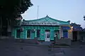 Historical building in Kobeliaky
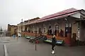 Bus station
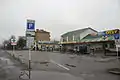 Shops in Kobeliaky
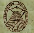 Seal of Kobeliaky Company of the Dnieper Pikeman Regiment (Russian Empire)
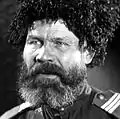 People's Actor of Ukraine Stepan Shkurat (from film "Chapayev", 1934)
References
- Ukrainian Zip Codes
- Как расшифровываются новые номера
- Чисельність наявного населення України на 1 січня 2022 [Number of Present Population of Ukraine, as of January 1, 2022] (PDF) (in Ukrainian and English). Kyiv: State Statistics Service of Ukraine. Archived (PDF) from the original on 4 July 2022.
- https://socialdata.org.ua/projects/mova-2001/
- "World Meteorological Organization Climate Normals for 1981–2010". World Meteorological Organization. Archived from the original on 17 July 2021. Retrieved 17 July 2021.
External links
- Kobeliaky
- Photogallery of the Kobeliaky city
- History of Kobeliaky city (in Ukrainian language)
- The murder of the Jews of Kobeliaky during World War II, at Yad Vashem website.
This article is issued from Wikipedia. The text is licensed under Creative Commons - Attribution - Sharealike. Additional terms may apply for the media files.