Kodiya (Gir Gadhada)
Kodiya is a village / panchayat[3] located in the Gir Gadhada Taluka of Gir Somnath district in Gujarat, India. Earlier, until August 2013, Kodiya was part of Una Taluka and Junagadh district.[4] The latitude 20.972618 and longitude 70.951495 are the geo-coordinate of the Village Kodiya. Gandhinagar is the state capital of Kodiya village which is located around 375 kilometres away from Kodiya.
Kodiya | |
|---|---|
Village | |
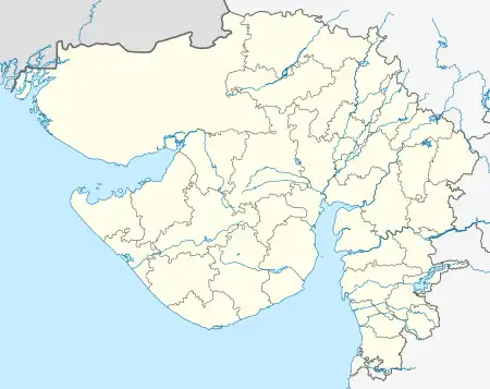
 Kodiya Location in Gujarat, India  Kodiya Kodiya (India) | |
| Coordinates: 20.972618°N 70.951495°E | |
| Country | |
| State | Gujarat |
| District | Gir Somnath |
| Taluka | Gir Gadhada |
| Government | |
| • Type | Panchayati raj (India) |
| • Body | Gram panchayat |
| Area | |
| • Total | 987.53 ha (2,440.24 acres) |
| Population (2011) | |
| • Total | 3,067[1] |
| Sex ratio 1591/1476♂/♀[1] | |
| Languages | |
| • Official | Gujarati |
| Time zone | UTC+5:30 (IST) |
| PIN | 362530[2] |
| Vehicle registration | GJ |
| Census code of Kodiya | 515249[1] |
| Nearest city | Gir Gadhada, Una |
| Website | girsomnathdp |
According to Census 2011, with the 551 families, the population of this village is 3067. Out of this, 1591 are males and 1476 are females. Most residents are dependent on agriculture. [1][2]
Demographics
According to the 2011 census of India, Kodiya has 551 households. The effective literacy rate (i.e. the literacy rate of population excluding children aged 6 and below) is 57.8% [1]
| Total | Male | Female | |
|---|---|---|---|
| Population | 3067 | 1591 | 1476 |
| Children aged below 6 years | 498 | 260 | 238 |
| Scheduled caste | 23 | 10 | 13 |
| Scheduled tribe | 42 | 17 | 25 |
| Literates | 1485 | 904 | 581 |
| Illiterates | 1582 | 687 | 895 |
| Total Workers | 1616 | 970 | 646 |
| Main workers | 1332 | 963 | 369 |
| Main workers: Cultivators | 464 | 370 | 94 |
| Main workers: Agricultural labourers | 686 | 423 | 263 |
| Main workers: Household industry workers | 2 | 1 | 1 |
| Main workers: Other | 180 | 169 | 11 |
| Marginal workers (total) | 284 | 7 | 277 |
| Marginal workers: Cultivators | 107 | 3 | 104 |
| Marginal workers: Agricultural labourers | 163 | 2 | 161 |
| Marginal workers: Household industry workers | - | - | - |
| Marginal workers: Others | 14 | 2 | 12 |
| Non-workers | 1451 | 621 | 830 |
List of Villages in Gir Gadhada Taluka[3]
Below is the Revenue records list of forty-three villages of Gir Gadhada Taluka including Gir Gadhada village.[3]
- Ambavad
- Ankolali
- Babariya
- Bediya
- Bhakha
- Bhiyal
- Bodidar
- Dhokadva
- Dhrabavad
- Dron
- Fareda
- Fatsar
- Fulka
- Gir Gadhada
- Harmadiya
- Itvaya
- Jamvala
- Jaragli
- Jhanjhariya
- Jhudvadli
- Juna Ugla
- Kanakiya
- Kaneri
- Kansariya
- Khilavad
- Kodiya
- Mahobatpara
- Motisar
- Nagadiya
- Nava Ugla
- Nitli
- Panderi
- Rasulpara
- Sanosri
- Sanvav
- Sonariya
- Sonpura
- Thordi
- Umedpara
- Undari
- Vadli
- Vadviyala
- Velakot
References
- "Page no. 244 to 249 - District Census Handbook - Junagadh" (PDF). 2011 Census of India. Directorate of Census Operations, Gujarat.
- "wikivillage article of Kodiya". 2011 Census of India. Wikivillage.in.
- "Notification: Gujarat Land Revenue Code 1879: Schedule B Villages of Girgadhada Taluka" (PDF). The Gujarat Government Gazette. Vol. 54, no. Extra No. 282. 9 September 2013.
- "About Gir Somnath | About Us | Collectorate - District Gir Somnath". Girsomnath.gujarat.gov.in. 15 February 2018. Retrieved 30 March 2018.