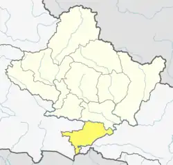
Kolhuwa
Kolhuwa is a village development committee in Nawalparasi District in the Lumbini Zone of southern Nepal. At the time of the 1991 Nepal census it had a population of 6,292 people living in 1,025 individual households.[1] .This VDC was merged in the Madhyabindu municipality on 19 September 2015 along with Tamasariya and Narayani Village development committees (VDCs).[2][3] The center of the municipality is established in the former Tamasariya VDC of Chormara Bazaar. After merging the three VDCs population it had a total population of 28,224 according to 2011 Nepal census.[4]
Kolhuwa
कोल्हुवा | |
|---|---|
 Kolhuwa Location in Nepal  Kolhuwa Kolhuwa (Nepal) | |
| Coordinates: 27.57°N 84.06°E | |
| Country | |
| Zone | Lumbini Zone |
| District | Nawalparasi District |
| Population (1991) | |
| • Total | 6,292 |
| Time zone | UTC+5:45 (Nepal Time) |
References
- "Nepal Census 2001". Nepal's Village Development Committees. Digital Himalaya. Archived from the original on October 12, 2008. Retrieved 18 December 2008.
- "26 new Municipalities announced". The Rising Nepal. Archived from the original on 2015-09-27. Retrieved 2015-09-18.
- "Govt announces 26 municipalities" (PDF). The Kathmandu Post. Archived from the original (PDF) on 2015-10-01. Retrieved 2015-09-18.
- Central Bureau of Statistics of Nepal: National Population and Housing Census 2011 Archived July 31, 2013, at the Wayback Machine
This article is issued from Wikipedia. The text is licensed under Creative Commons - Attribution - Sharealike. Additional terms may apply for the media files.
