Kozara
Kozara (Serbian Cyrillic: Козара) is a mountain in western Bosnia and Herzegovina, in the town of Kozarac and in the Bosanska Krajina region, bounded by the Sava River to the north, the Vrbas to the east, the Sana to the south, and the Una to the west. Its tallest peak is Lisina (978 m). In 1942 Kozara was the site of the Kozara Offensive, part of the Yugoslav National Liberation War and Partisan resistance during World War II.[2][3]
Side of the mountain called 'Kozarački kamen' - overlooking hamlet of Kozarac
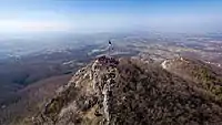
Kozarački kamen
| Kozara | |
|---|---|
| Козара | |
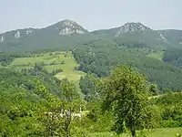
 View of the tallest peak, Lisina | |
| Highest point | |
| Elevation | 977 m (3,205 ft)[1] |
| Coordinates | 44°58′15″N 16°58′39″E[1] |
| Geography | |
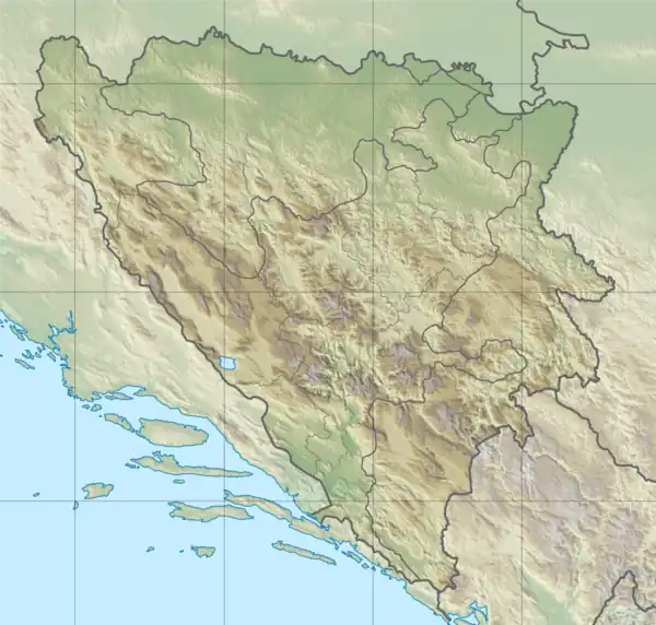 Kozara Location in Bosnia and Herzegovina | |
| Location | Kozarac, Bosnia and Herzegovina |
| Parent range | Pannonian island mountains |
Peaks
| Name | Height (m) |
|---|---|
| Lisina | 977 |
| Gola planina | 876 |
| Mrakovica | 806 |
| Glavuša | 793 |
| Bešića poljana | 784 |
| Talavića poljana | 780 |
| Jarčevica | 740 |
| Vrnovačka glava | 719 |
| Benkovac-Jurišina kosa | 705 |
| Zečiji kamen | 667 |
| Kozarački kamen | 659 |
| Šupljikovac | 652 |
| Vitlovska kosa | 589 |
| Palež | 542 |
| Mednjak | 440 |
References
Wikimedia Commons has media related to Kozara.
- "Topografska karta Prijedor 2-2".
- "Kozara". Kozara National Park.
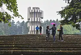
- "Kozara Memorial". Memorial Museums.
This article is issued from Wikipedia. The text is licensed under Creative Commons - Attribution - Sharealike. Additional terms may apply for the media files.