Ksi Sii Aks
The Ksi Sii Aks (formerly Tseax River) is a tributary of the Nass River in northwestern British Columbia, Canada.[3][6] It is most notable as the namesake of Tseax Cone, a volcano within its basin that was responsible for an eruption in the 17th century that killed 2,000 Nisga'a people. Prior to the eruption, the Nisga'a name for this river was Ksi Gimwits'ax.[3] Buried by the eruption, it eventually resurfaced. The Nisga'a recognized it as the same stream but renamed it Ksi Sii Aks: sii aks means "new body of water".[3]
| Ksi Sii Aks | |
|---|---|
 Ksi Sii Aks | |
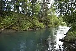
 Mouth of Ksi Sii Aks | |
| Location | |
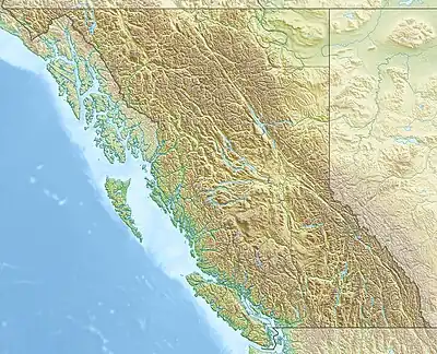
| Country | Canada |
| Province | British Columbia |
| District | Cassiar Land District |
| Physical characteristics | |
| Source | Nass Ranges |
| • location | Hazelton Mountains |
| • coordinates | 54°59′13″N 128°55′15″W[1] |
| • elevation | 1,310 m (4,300 ft)[2] |
| Mouth | Nass River |
• coordinates | 55°13′20″N 129°6′24″W[3] |
• elevation | 29 m (95 ft)[2] |
| Length | 45 km (28 mi)[4] |
| Basin size | 610 km2 (240 sq mi)[5] |
| Discharge | |
| • average | 21 m3/s (740 cu ft/s)[5] |
| Basin features | |
| Tributaries | |
| • left | Poupard Creek, May Creek, Alder Creek, Aquila Creek, Auk Creek |
| • right | Tumbling Creek, Jay Creek, Crater Creek, Bubo Creek, Canard Creek, Eider Creek, Teal Creek, Fulmar Creek, McLeod Creek, Gitzyon Creek, Gingit Creek |
| Topo map | 103I14 Oscar Peak 103I15 Kitsumkalum Lake 103P2 Lava Lake 103P3 Tseax River |
As prescribed by terms of the Nisga'a Treaty, the Tseax River is now officially named the Ksi Sii Aks.
Ksi Sii Aks flows about 45 km (28 mi) north to the Nass River.[4] From its source near Sand Lake the river flows through Sand Lake,[7] Gainor Lake,[8] and Lava Lake.[9] It collects many tributary streams, the largest of which are Poupard Creek,[10] May Creek,[11] Alder Creek,[12] Crater Creek,[13] Auk Creek,[14] and Gitzyon Creek.[15]
References
- Derived using BCGNIS, topographic maps and TopoQuest.
- Elevation derived from ASTER Global Digital Elevation Model, using GeoLocator, BCGNIS coordinates, and topographic maps.
- "Ksi Sii Aks". BC Geographical Names.
- Length measured using Google Maps path tool, BCGNIS coordinates, topographic maps, and TopoQuest.
- "Northwest Water Tool". BC Water Tool. GeoBC, Integrated Land Management Bureau, Ministry of Agriculture and Lands, Government of British Columbia. Retrieved 2023-09-26.
- "Tseax River". BC Geographical Names.
- "Sand Lake". BC Geographical Names.
- "Gainor Lake". BC Geographical Names.
- "Lava Lake". BC Geographical Names.
- "Poupard Creek". BC Geographical Names.
- "May Creek". BC Geographical Names.
- "Alder Creek". BC Geographical Names.
- "Crater Creek". BC Geographical Names.
- "Auk Creek". BC Geographical Names.
- "Gitzyon Creek". BC Geographical Names.