Pattani, Thailand
Pattani is a town (thesaban mueang) in the far south of Thailand, near the border with Malaysia. It is the capital of Pattani Province. The city has a population of 44,353 (2018). It covers the whole tambon Sabarang, Anoru and Chabang Tiko of Mueang Pattani district.
Pattani
ปัตตานี | |
|---|---|
| เทศบาลเมืองปัตตานี | |
.jpg.webp) Pattani | |
 Seal | |
| Nickname: Tani | |
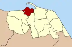 Location of Mueang Pattani district (red) in Pattani Province (Pattani town is located within Mueang Pattani district.) | |
 Pattani Location in Thailand | |
| Coordinates: 6°51′59″N 101°15′3″E | |
| Country | Thailand |
| Province | Pattani |
| District | Mueang Pattani |
| Government | |
| • Mayor | Pitak Korkiatpitak |
| Area | |
| • Town | 4.78 km2 (1.85 sq mi) |
| • Metro | 96.86 km2 (37.40 sq mi) |
| Population (2018) | |
| • Town | 44,353 |
| • Density | 9,300/km2 (24,000/sq mi) |
| Time zone | UTC+7 (ICT) |
| Area code | (+66) 73 |
| Website | pattanicity |
Pattani lies 1,056 km south of Bangkok,[1] and is located at the mouth of the Pattani River. The historic centre of Patani was originally located a few miles away near the Krue Se Mosque, but developed at the present location after the older Patani was captured and sacked in 1785.
The local dialect of Malay is called Pattani Malay or Yawi in Thai (derived from Jawi).
Etymology
Some believe that the name Pattani originated from Malay name Patani (Jawi: ڤطاني), which can mean "this beach" in Pattani Malay language. (In standard Malay, this would be pantai ini.) According to a legend, the founder of Pattani was a raja from Kota Malikha named Phaya Tunakpa. Phaya Tunakpa went hunting one day and saw a beautiful albino mouse-deer the size of a goat, which then disappeared. He asked his men where the animal had gone, and they replied: "Pata ning lah!" ("This beach!" in the Pattani Malay language). They searched for the mouse-deer but found instead an old couple, where the old man identified himself as Che' Tani ("Mister Tani"). The old man said that he was sent by the raja's grandfather to build a new town further beyond but had fallen ill on the journey; as he could not go any further, he stayed at that place. The raja then ordered a town be built at the site where the mouse-deer had disappeared. The town became Patani, which is believed to be named either after "this beach" where the mouse-deer had disappeared. Alternatively, it has also been said to be named after the old man as Pak Tani meaning "Father Tani".[2]
Some also say the word Pattani is derived from "Petani" in Malay which means "farmer". Another suggestion is that it derives from a Sanskrit word pathini, meaning "virgin nymph"; Pathini is also said to be the title of a daughter of Merong Mahawangsa, founder of the preceding kingdom of Langkasuka.[3]
History
Pattani is located at the mouth of the Pattani River. The river may have changed course and empty into the sea at the current location in the 16th century. A small port existed in the current location at Kuala Bekah at the mouth of Sungai Patani by the early 17th century.[4] However, the older historical centre of the Pattani Kingdom that ruled over the region of Patani was located a 6–7 km to the east of the present city; near Ban Kru Se or Kampong Kersik, which is where the Krue Se Mosque is located.[5] The older Pattani was captured and sacked by the Siamese, and a new town centre later developed in the current location and the Sultan moved to Cabang Tiga at the southern side of present-day Pattani in the 19th century. The Patani City municipality was established in 1935 by royal decree.[6][7]
Climate
Pattani has a tropical monsoon climate according to the Köppen climate classification, with a lengthy wet season and a brief dry season. The temperatures and humidity are high year round, with slightly higher temperatures in April, just as the monsoon arrives. The wet season is long, lasting May-December, and the dry season short, covering only January-April. The months of October, November, and December are particularly wet.
| Climate data for Pattani (1991–2020) | |||||||||||||
|---|---|---|---|---|---|---|---|---|---|---|---|---|---|
| Month | Jan | Feb | Mar | Apr | May | Jun | Jul | Aug | Sep | Oct | Nov | Dec | Year |
| Record high °C (°F) | 34.3 (93.7) |
35.9 (96.6) |
37.0 (98.6) |
37.9 (100.2) |
38.0 (100.4) |
36.6 (97.9) |
36.3 (97.3) |
35.8 (96.4) |
36.0 (96.8) |
35.0 (95.0) |
34.0 (93.2) |
33.9 (93.0) |
38.0 (100.4) |
| Average high °C (°F) | 31.1 (88.0) |
32.3 (90.1) |
33.5 (92.3) |
34.3 (93.7) |
34.1 (93.4) |
33.5 (92.3) |
33.3 (91.9) |
33.2 (91.8) |
32.7 (90.9) |
32.0 (89.6) |
30.7 (87.3) |
30.1 (86.2) |
32.57 (90.63) |
| Daily mean °C (°F) | 26.3 (79.3) |
26.7 (80.1) |
27.5 (81.5) |
28.4 (83.1) |
28.5 (83.3) |
28.1 (82.6) |
27.8 (82.0) |
27.7 (81.9) |
27.4 (81.3) |
27.0 (80.6) |
26.6 (79.9) |
26.2 (79.2) |
27.35 (81.23) |
| Average low °C (°F) | 22.7 (72.9) |
22.4 (72.3) |
23.0 (73.4) |
24.0 (75.2) |
24.5 (76.1) |
24.3 (75.7) |
24.0 (75.2) |
23.9 (75.0) |
23.9 (75.0) |
23.9 (75.0) |
23.8 (74.8) |
23.3 (73.9) |
23.64 (74.55) |
| Record low °C (°F) | 18.6 (65.5) |
16.7 (62.1) |
18.5 (65.3) |
17.4 (63.3) |
21.6 (70.9) |
20.6 (69.1) |
20.4 (68.7) |
21.0 (69.8) |
20.8 (69.4) |
21.3 (70.3) |
21.0 (69.8) |
19.7 (67.5) |
16.7 (62.1) |
| Average precipitation mm (inches) | 94.2 (3.71) |
36.2 (1.43) |
54.1 (2.13) |
83.2 (3.28) |
133.9 (5.27) |
118.7 (4.67) |
128.8 (5.07) |
147.0 (5.79) |
140.8 (5.54) |
221.8 (8.73) |
400.5 (15.77) |
392.8 (15.46) |
1,952 (76.9) |
| Average precipitation days (≥ 1.0 mm) | 6.2 | 2.4 | 4.7 | 5.9 | 10.5 | 9.8 | 9.5 | 10.3 | 11.7 | 15.4 | 18.5 | 15.3 | 120.2 |
| Average relative humidity (%) | 8.0 | 81.6 | 78.9 | 78.6 | 78.2 | 79.3 | 79.8 | 79.5 | 80.9 | 83.8 | 86.5 | 85.6 | 81.0 |
| Mean monthly sunshine hours | 145.7 | 166.7 | 148.8 | 144.0 | 114.7 | 111.0 | 114.7 | 114.7 | 108.0 | 111.6 | 105.0 | 108.5 | 1,493.4 |
| Mean daily sunshine hours | 4.7 | 5.9 | 4.8 | 4.8 | 3.7 | 3.7 | 3.7 | 3.7 | 3.6 | 3.6 | 3.5 | 3.5 | 4.1 |
| Source 1: World Meteorological Organization[8] | |||||||||||||
| Source 2: Office of Water Management and Hydrology, Royal Irrigation Department (sun 1981–2010)[9](extremes)[10] | |||||||||||||
References
- "Distance: Bangkok to Patani". Google Maps. Retrieved 22 May 2015.
- Wyatt, David K. (December 1967). "A Thai Version of Newbold's "Hikayat Patani"". Journal of the Malaysian Branch of the Royal Asiatic Society. 40 (2 (212)): 16–37. JSTOR 41491922.
- "{ms} Sejarah Malaysia - Asal Usul nama Sungai Petani". Sejarahmalaysia.pnm.my. Archived from the original on 2013-06-03. Retrieved 2012-08-24.
- Bougas, Wayne (1990). "Patani in the Beginning of the XVII Century". Archipel. 39: 129, 136. doi:10.3406/arch.1990.2624.
- Chaiwat Satha-anand. "Kru-ze: A Theatre for Renegotiating Muslim Identity". Sojourn: Journal of Social Issues in Southeast Asia. 8 (1): 195–218. JSTOR 41035733.
- "ประวัติการจัดตั้งเทศบาล". Archived from the original on 2016-09-09. Retrieved 2015-04-28.
- "พระราชกฤษฎีกาจัดตั้งเทศบาลเมืองปัตตานี จังหวัดปัตตานี พุทธศักราช ๒๔๗๘" (PDF). ราชกิจจานุเบกษา. 52: 2104–2108. 25 March 1935. Archived from the original (PDF) on March 4, 2016.
- "World Meteorological Organization Climate Normals for 1991–2020". World Meteorological Organization. Retrieved 12 October 2023.
- "ปริมาณการใช้น้ำของพืชอ้างอิงโดยวิธีของ Penman Monteith (Reference Crop Evapotranspiration by Penman Monteith)" (PDF) (in Thai). Office of Water Management and Hydrology, Royal Irrigation Department. p. 126. Retrieved 8 August 2016.
- "Climatological Data for the Period 1981–2010". Thai Meteorological Department. Retrieved 4 August 2016.