Kuchuk (river)
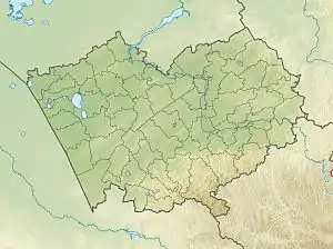
The Kuchuk (Russian: Кучук) is a river in Altai Krai, Russia. The river is 121 kilometres (75 mi) long and has a catchment area of 1,020 square kilometres (390 sq mi).[1]
| Kuchuk Кучук | |
|---|---|
 Mouth location in Altai Krai, Russia | |
| Location | |
| Country | Russia |
| Physical characteristics | |
| Source | Near Voznesenka |
| • coordinates | 52°15′48″N 80°24′51″E |
| • elevation | 277 metres (909 ft) |
| Mouth | Lake Kuchuk |
• coordinates | 52°44′46″N 79°50′27″E |
• elevation | 98 metres (322 ft) |
| Length | 121 km (75 mi) |
| Basin size | 1,020 km2 (390 sq mi) |
The basin of the river is located in the Rodinsky and Blagoveshchensky districts. There are a number of villages near its banks, such as Nizhny Kuchuk, Stepnoy Kuchuk, Kayaushka, Novotroitsk, Voznesenka and Tsentralnoye. The ghost-town of Verkh-Nezamay is also located by the river. Founded in 1910, it was abolished in 2003.[2][3]
Course
The Kuchuk river system is an endorheic basin between the Ob and the Irtysh rivers. The sources are at the southwestern end of the Ob Plateau, in lake Zhir-Kain,[1] a small lake located 8 kilometres (5.0 mi) to the south of Voznesenka. In its upper course the river flows northwards, then it bends westwards and flows meandering in a roughly western direction within the Kulunda Plain. In its last stretch it heads in a roughly northwestern direction. Finally it meets the eastern shore of Lake Kuchuk about 5 km (3.1 mi) northwest of Nizhny Kuchuk.[4]
See also
References
- "Река Кучук in the State Water Register of Russia". textual.ru (in Russian).
- List of populated places in the Siberian region. - Volume 1. Districts of South-Western Siberia. - Novosibirsk: Siberian Regional Executive Committee. Statistical department, 1928. - 831 p.
- Google Earth
- "N-44 Topographic Chart (in Russian)". Retrieved 7 July 2022.
External links
- The syntaxonomy of the meadow vegetation of Kulunda and Kasmala pine forest strips (Altai Territory)