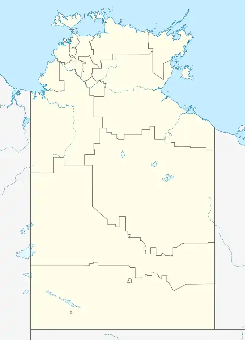
Kulgera, Northern Territory
Kulgera is a locality in the Northern Territory of Australia. It is 275 kilometres (171 mi) south of Alice Springs and 21 kilometres (13 mi) north of the border with South Australia, making it the southernmost permanent settlement in the Northern Territory. It sits on the junction of the Stuart Highway and the road to Aputula. In the 2006 Australian census it had a population of 50.
| Kulgera Ghan[1], Northern Territory | |||||||||
|---|---|---|---|---|---|---|---|---|---|
.jpg.webp) Kulgera Pub | |||||||||
 Kulgera | |||||||||
| Coordinates | 25°50′27″S 133°18′02″E[1] | ||||||||
| Population | 50 (2006 census) | ||||||||
| Postcode(s) | 0872 | ||||||||
| Elevation | 509[2] m (1,670 ft) | ||||||||
| LGA(s) | MacDonnell Region[1] | ||||||||
| Territory electorate(s) | Namatjira | ||||||||
| Federal division(s) | Lingiari | ||||||||
| |||||||||
History
Kulgera is the Pitjantjatjara name for an outcrop of granite rocks just east of the settlement. According to Nicolas Rothwell, Kulgera is derived from kalgka in the Pertam language of the mountains and that word "refers to a particularly private recess of a private part of the female anatomy".[3]
A pastoral lease of 1,370 square kilometres (530 sq mi) to the north east of the outcrop was granted to the Coulthard family in 1928 and was named Kulgera Station.[4][5]
Transport
Kulgera is located on Stuart Highway. It is served by Greyhound Australia. Being the closest settlement to the South Australia/Northern Territory border makes it a well-known locality among travellers.[3]
Kulgera railway station is 12 km east of the settlement on the Adelaide–Darwin railway. The Ghan, run by Journey Beyond Rail between Adelaide and Darwin arrives twice weekly in each direction.[6]
Kulgera Airport (IATA: KGR, ICAO: YKUL) is adjacent to the settlement but is served only by charter flights.
Climate
Climate staticstics were monitored in Kulgera since 1968.
| Climate data for Kulgera | |||||||||||||
|---|---|---|---|---|---|---|---|---|---|---|---|---|---|
| Month | Jan | Feb | Mar | Apr | May | Jun | Jul | Aug | Sep | Oct | Nov | Dec | Year |
| Record high °C (°F) | 47.0 (116.6) |
45.5 (113.9) |
43.8 (110.8) |
39.9 (103.8) |
34.0 (93.2) |
32.0 (89.6) |
30.7 (87.3) |
34.5 (94.1) |
38.6 (101.5) |
43.0 (109.4) |
44.7 (112.5) |
47.0 (116.6) |
47.0 (116.6) |
| Average high °C (°F) | 37.0 (98.6) |
35.7 (96.3) |
32.4 (90.3) |
28.3 (82.9) |
22.9 (73.2) |
18.9 (66.0) |
19.2 (66.6) |
22.1 (71.8) |
27.1 (80.8) |
30.8 (87.4) |
33.6 (92.5) |
35.1 (95.2) |
28.6 (83.5) |
| Average low °C (°F) | 22.1 (71.8) |
21.3 (70.3) |
18.0 (64.4) |
13.9 (57.0) |
9.0 (48.2) |
5.2 (41.4) |
4.8 (40.6) |
6.6 (43.9) |
11.3 (52.3) |
15.3 (59.5) |
18.4 (65.1) |
20.3 (68.5) |
13.9 (56.9) |
| Record low °C (°F) | 9.0 (48.2) |
10.8 (51.4) |
7.0 (44.6) |
1.5 (34.7) |
−2.1 (28.2) |
−4.5 (23.9) |
−4.8 (23.4) |
−2.8 (27.0) |
−1.0 (30.2) |
2.9 (37.2) |
5.4 (41.7) |
9.5 (49.1) |
−4.8 (23.4) |
| Average rainfall mm (inches) | 28.9 (1.14) |
32.5 (1.28) |
29.1 (1.15) |
13.3 (0.52) |
12.3 (0.48) |
15.8 (0.62) |
11.6 (0.46) |
8.5 (0.33) |
14.8 (0.58) |
19.4 (0.76) |
25.2 (0.99) |
32.8 (1.29) |
244.2 (9.6) |
| Source: Bureau of Meteorology[2] | |||||||||||||
In popular culture
Kulgera features in the Redgum song "Lear Jets Over Kulgera" from their 1981 album Brown Rice and Kerosine.
References
- "Place Names Register Extract for Kulgera". NT Place Names Register. Northern Territory Government. Retrieved 26 April 2019.
- "Climate statistics for Australian locations - Kulgera". BOM. Retrieved 29 May 2021.
- "A farm by any other name" by Nicolas Rothwell, The Australian, 23 December 2013 (subscription required)
- Malcolm Gordon (1991). Outback Australia at cost: a traveller's guide to the Northern Territory and Kimberley. Little Hill Press. p. 164. ISBN 1863150234.
- Tim Rowse (2002). White Flour, White Power: From Rations to Citizenship in Central Australia. Cambridge University Press. p. 52. ISBN 0521523273.
- Australian Railmaps, "Rail Map - Perth to Adelaide, Central and Northern Australia". Accessed 12 June 2007.