Kulshan caldera
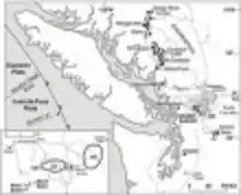
The Kulshan caldera is a Pleistocene volcano in the North Cascades of Washington and one of the few calderas identified in the entire Cascade Range.[1][2] It is the product of the Mount Baker volcanic field, which has a history stretching back to possibly 3.722 million years ago.

.jpg.webp)
Geology
Precaldera activity
About ten precaldera units have been identified,[3] but none have been attributed to a major edifice like the Mount Baker we see today. Four of the ten units are composed mostly of rhyodacite which is similar in composition to the rhyodacite that was erupted in the climactic eruption. The other six are andesite dikes and scraps of dacite that are outside of the caldera margin; these six are prominent at Barometer Mountain, Slate Mountain, Chowder Ridge, Lake Ann, and Park Glacier. The rhyodacite units can be found at Dobbs Cleaver, Cougar Divide, Deadhorse Creek, and Swift Rainbow divide.[3] Some of these dikes contain pyroclastic material which indicates that explosive activity occurred before the climactic eruption.
Climactic eruption

Formation of the caldera about 1.149[3] million years ago was accompanied by the largest eruption in the history of the Mount Baker volcanic field.[4] The eruption was subglacial, blasting upward through the continental ice sheet.[1] Over 124 km3[5] (29.7 cubic miles) of rhyodacite magma erupted from a shallow magma chamber in an ultra-plinian eruption. The magma in this water/ice interaction was quenched and shattered in phreatomagmatic explosions to produce only small fragments of pumice.[6] As the magma escaped from the shallow reservoir, the rock above it collapsed downward forming a massive 4.5 x 8 km (2.8 x 5 mi) depression. As the eruption progressed, the caldera was filled with up to 1,000 meters (3,280 ft.) of ignimbrite and tephra.[3] Tephra fell beyond the limits of the ice sheet and is preserved today at Lake Tapps[7] 125 mi (201 km) south of the caldera, and at Washtucna, Washington 300 km southeast of the caldera.[8] While rhyodacite took up the bulk composition of the eruption some andesitic pumice can be sparsely found in the rhyodacite bands.[3] After the eruption, subsequent glacial recession removed most of the tephra fallout near the caldera. Eventually stripping away all remnants of extracaldera ash flows.[3] The eruption that created the caldera was significantly larger in volume than the one that produced Crater Lake in Oregon.
Postcaldera volcanism
After the climactic eruption between 1.149 and 0.99 million years ago, about a dozen dike-fed eruptions produced rhyodacitic lava domes and lava flows inside the caldera. Another volcanic phase 1.1 to 0.5 million years ago emplaced over 60 andesite dikes, the eruptive products of which have since been stripped away by glacial erosion. It is speculated that the eruptive rocks from this volcanic phase formed one or more large andesitic cone now completely removed.[9]

References
- Hildreth, Wes. "Kulshan caldera: A Quaternary subglacial caldera in the North Cascades, Washington". pubs.geoscienceworld.org. Retrieved 2022-12-09.
- Harris, Stephen L. (1988). Fire Mountains of the West: The Cascade and Mono Lake Volcanoes. Missoula, Montana: Mountain Press Publishing Company. p. 534. ISBN 978-0-87842-220-3.
- Hildreth, Wes (2003). "Rhyodacites of Kulshan caldera, North Cascades of Washington: Postcaldera lavas that span the Jaramillo". Journal of Volcanology and Geothermal Research. 3 (130): 38.
- Hildreth, Wes. "Eruptive history and geochronology of the Mount Baker volcanic field, Washington". pubs.geoscienceworld.org. Retrieved 2022-12-09.
- Smith, V.C. (2016). "Identification of a Kulshan caldera correlative tephra in the Palouse loess of Washington State, northwest USA". Quaternary Research. 2 (86): 24 – via ResearchGate.
- "Pumice: Igneous Rock - Pictures, Definition & More". geology.com. Retrieved 2022-12-12.
- Westgate, J. A.; Easterbrook, D. J.; Naeser, N. D.; Carson, R. J. (1987-11-01). "Lake Tapps tephra: An early Pleistocene stratigraphic marker in the Puget Lowland, Washington". Quaternary Research. 28 (3): 340–355. Bibcode:1987QuRes..28..340W. doi:10.1016/0033-5894(87)90002-0. ISSN 0033-5894. S2CID 129429216.
- King, Georgina; Pearce, Nick; Roberts, Helen; Smith, Victoria; et al. (2016). "Identification of a Kulshan caldera correlative tephra in the Palouse loess of Washington State, northwest USA". Quaternary Research. 86 (2): 232–241. Bibcode:2016QuRes..86..232K. doi:10.1016/j.yqres.2016.06.004. S2CID 132977164.
- "The Eruption History of Mount Baker". United States Geological Survey. 2013-10-01. Retrieved 2019-04-19.
External links
![]() Media related to Kulshan Caldera at Wikimedia Commons
Media related to Kulshan Caldera at Wikimedia Commons
![]() This article incorporates public domain material from websites or documents of the United States Geological Survey.
This article incorporates public domain material from websites or documents of the United States Geological Survey.