Kunjathur
Kunjathur is a census town in Kasaragod district in the state of Kerala, India.[1] It is 22 km (14 mi) south of Mangalore.
Kunjathur | |
|---|---|
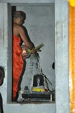 Mahalingeshwara Temple, Kunjathur | |
| Nickname: Kunja Nadu | |
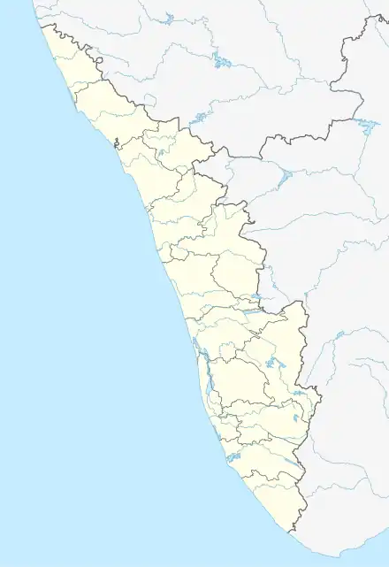 Kunjathur Location in Kerala, India | |
| Coordinates: 12°44′35″N 74°53′10″E | |
| Country | |
| State | Kerala |
| District | Kasaragod |
| Government | |
| • Type | Panchayati raj (India) |
| • Body | Manjeshwar Grama Panchayat |
| Area | |
| • Total | 12.65 km2 (4.88 sq mi) |
| Population (2011) | |
| • Total | 13,633 |
| • Density | 1,100/km2 (2,800/sq mi) |
| Languages | |
| • Official | Malayalam, Kannada, English |
| • Spoken | Malayalam, Tulu, Kannada |
| Time zone | UTC+5:30 (IST) |
| Vehicle registration | KL-14 |
Demographics
As of 2011 Census, Kunjathur had a population of 13,633 where 6,729 are males and 6,904 are females. Kunjathur census town has an area of 12.65 km2 (4.88 sq mi) with 2,634 families residing in it. In Kunjathur, 12.3% of the population was under 6 years of age. Kunjathur had an average literacy of 90.2% lower than state average of 94%: male literacy was 94.9% and female literacy was 85.7%.[2]
Religions
As of 2011 census, Kunjathur town had 13,633 population, which comprises 6,824 Muslims (50.1%), 5,924 Hindus (43.5%), 852 Christians (6.2%) and Others (0.2%).[3]
Transportation
Local roads have access to National Highway No.66 which connects to Mangalore in the north and Calicut in the south. The nearest railway station is Manjeshwar on Shoranur-Mangalore section under southern railway zone. The nearest airport is at Mangalore.
Languages
This locality is an essentially multi-lingual region. The people speak Malayalam, Tulu, Beary bashe, Kannada and Konkani and Dakhini Urdu . Migrant workers also speak Hindi and Tamil languages.
Administration
This village is part of Manjeswaram assembly constituency which is again part of Kasaragod (Lok Sabha constituency)
References
- "Census of India : Villages with population 5000 & above". Registrar General & Census Commissioner, India. Archived from the original on 8 December 2008. Retrieved 10 December 2008.
- Kerala, Directorate of Census Operations. District Census Handbook, Kasaragod (PDF). Thiruvananthapuram: Directorateof Census Operations,Kerala. p. 100,101. Retrieved 14 July 2020.
- "Religion – Kerala, Districts and Sub-districts". Census of India 2011. Office of the Registrar General.
| Major Cities | |
|---|---|
| Taluks | |