Kurşunluk
Kurşunluk (formerly: Bölme)[1] is a neighbourhood of the city Uşak, Uşak Province, Turkey.[2] Its population is 2,455 (2022).[3] It is just 5 kilometres (3.1 mi) south west of Uşak. The settlement was founded about 200 years ago and it was declared a seat of township in 1999. The main economic activity is dairying. Cereal agriculture is another activity.
Kurşunluk
Bölme | |
|---|---|
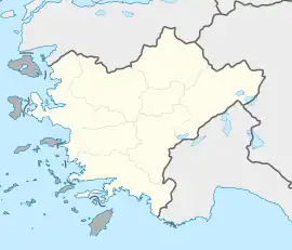
 Kurşunluk Location in Turkey  Kurşunluk Kurşunluk (Turkey Aegean) | |
| Coordinates: 38°37′N 29°22′E | |
| Country | Turkey |
| Province | Uşak |
| District | Uşak |
| Municipality | Uşak |
| Elevation | 900 m (3,000 ft) |
| Population (2022) | 2,455 |
| Time zone | TRT (UTC+3) |
| Postal code | 64420 |
| Area code | 0276 |
References
- Kurşunluk, nisanyanmap.com
- Mahalle, Turkey Civil Administration Departments Inventory. Retrieved 1 March 2023.
- "Address-based population registration system (ADNKS) results dated 31 December 2022, Favorite Reports" (XLS). TÜİK. Retrieved 13 March 2023.
This article is issued from Wikipedia. The text is licensed under Creative Commons - Attribution - Sharealike. Additional terms may apply for the media files.