Waipahihi
Waipahihi (Māori: Waipahīhī) is a suburb in Taupō, based on the eastern shores of Lake Taupō on New Zealand's North Island.[3]
Waipahihi | |
|---|---|
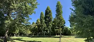 Waipahihi Botanical Gardens | |
| Coordinates: 38.711°S 176.096°E | |
| Country | New Zealand |
| City | Taupō |
| Local authority | Taupō District Council |
| Electoral ward | Taupō Ward |
| Area | |
| • Land | 393 ha (971 acres) |
| Population (June 2022)[2] | |
| • Total | 4,870 |
| Taupō Central | Hilltop | |
| (Lake Taupō) |
|
Maunganamu |
| Wharewaka |
The local Waipahīhī Marae is a meeting place of the Ngāti Tūwharetoa hapū of Ngāti Hinerau and Ngāti Hineure.[4] It includes the Kurapoto meeting house.[5]
Demographics
Waipahihi covers 3.93 km2 (1.52 sq mi)[1] and had an estimated population of 4,870 as of June 2022,[2] with a population density of 1,239 people per km2.
| Year | Pop. | ±% p.a. |
|---|---|---|
| 2006 | 3,915 | — |
| 2013 | 3,987 | +0.26% |
| 2018 | 4,500 | +2.45% |
| Source: [6] | ||
Waipahihi had a population of 4,500 at the 2018 New Zealand census, an increase of 513 people (12.9%) since the 2013 census, and an increase of 585 people (14.9%) since the 2006 census. There were 1,689 households, comprising 2,250 males and 2,250 females, giving a sex ratio of 1.0 males per female, with 930 people (20.7%) aged under 15 years, 672 (14.9%) aged 15 to 29, 1,992 (44.3%) aged 30 to 64, and 906 (20.1%) aged 65 or older.
Ethnicities were 84.3% European/Pākehā, 20.9% Māori, 2.6% Pacific peoples, 3.2% Asian, and 2.3% other ethnicities. People may identify with more than one ethnicity.
The percentage of people born overseas was 17.2, compared with 27.1% nationally.
Although some people chose not to answer the census's question about religious affiliation, 54.0% had no religion, 34.4% were Christian, 1.5% had Māori religious beliefs, 0.7% were Hindu, 0.3% were Muslim, 0.7% were Buddhist and 1.1% had other religions.
Of those at least 15 years old, 645 (18.1%) people had a bachelor's or higher degree, and 549 (15.4%) people had no formal qualifications. 618 people (17.3%) earned over $70,000 compared to 17.2% nationally. The employment status of those at least 15 was that 1,833 (51.3%) people were employed full-time, 552 (15.5%) were part-time, and 90 (2.5%) were unemployed.[6]
| Name | Area (km2) | Population | Density (per km2) | Households | Median age | Median income |
|---|---|---|---|---|---|---|
| Waipahihi | 2.56 | 2,172 | 848 | 855 | 46.4 years | $36,300[7] |
| Richmond Heights | 1.37 | 2,328 | 1,699 | 834 | 37.2 years | $32,500[8] |
| New Zealand | 37.4 years | $31,800 |
Education
Waipahihi School is a co-educational Year 1-6 state primary school,[9][10] with a roll of 362 as of April 2023.[11][12]
References
- "ArcGIS Web Application". statsnz.maps.arcgis.com. Retrieved 15 November 2022.
- "Population estimate tables - NZ.Stat". Statistics New Zealand. Retrieved 25 October 2022.
- Hariss, Gavin. "Waipahihi, Waikato". topomap.co.nz. NZ Topo Map.
- "Te Kāhui Māngai directory". tkm.govt.nz. Te Puni Kōkiri.
- "Māori Maps". maorimaps.com. Te Potiki National Trust.
- "Statistical area 1 dataset for 2018 Census". Statistics New Zealand. March 2020. Waipahihi (189200) and Richmond Heights (189300).
- 2018 Census place summary: Waipahihi
- 2018 Census place summary: Richmond Heights
- "Waipahihi School Official School Website". waipahihi.school.nz.
- "Waipahihi School Ministry of Education School Profile". educationcounts.govt.nz. Ministry of Education.
- "New Zealand Schools Directory". New Zealand Ministry of Education. Retrieved 12 December 2022.
- "Waipahihi School Education Review Office Report". ero.govt.nz. Education Review Office.