La Châtre
La Châtre (French pronunciation: [la ʃatʁ] ⓘ) is a commune in the Indre department in central France.
La Châtre | |
|---|---|
Subprefecture and commune | |
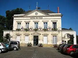 Town hall | |
.svg.png.webp) Coat of arms | |
Location of La Châtre | |
 La Châtre  La Châtre | |
| Coordinates: 46°34′59″N 1°59′16″E | |
| Country | France |
| Region | Centre-Val de Loire |
| Department | Indre |
| Arrondissement | La Châtre |
| Canton | La Châtre |
| Government | |
| • Mayor (2020–2026) | Patrick Judalet[1] |
| Area 1 | 6.06 km2 (2.34 sq mi) |
| Population | 4,048 |
| • Density | 670/km2 (1,700/sq mi) |
| Time zone | UTC+01:00 (CET) |
| • Summer (DST) | UTC+02:00 (CEST) |
| INSEE/Postal code | 36046 /36400 |
| Elevation | 198–263 m (650–863 ft) (avg. 222 m or 728 ft) |
| 1 French Land Register data, which excludes lakes, ponds, glaciers > 1 km2 (0.386 sq mi or 247 acres) and river estuaries. | |
Population
|
| ||||||||||||||||||||||||||||||||||||||||||||||||||||||||||||||||||||||||||||||||||||||||||||||||||||||||||||||||||
| Source: EHESS[3] and INSEE (1968-2017)[4] | |||||||||||||||||||||||||||||||||||||||||||||||||||||||||||||||||||||||||||||||||||||||||||||||||||||||||||||||||||
Personalities
- It was the birthplace of Henri de Latouche and Emile Acollas. André Boillot the auto racing driver crashed here in 1932 and died from his injuries.
- George Sand lived for most of her life at Nohant-Vic near La Châtre.
- From 1938 to his death in 1953, Jean de Boschère lived in La Châtre with his companion Elizabeth d'Ennetières.
- Birthplace of Adolphe-Simon Neboux (1806–1844), surgeon and naturalist
References
- "Répertoire national des élus: les maires" (in French). data.gouv.fr, Plateforme ouverte des données publiques françaises. 13 September 2022.
- "Populations légales 2020". The National Institute of Statistics and Economic Studies. 29 December 2022.
- Des villages de Cassini aux communes d'aujourd'hui: Commune data sheet La Châtre, EHESS (in French).
- Population en historique depuis 1968, INSEE
Wikimedia Commons has media related to La Châtre.
This article is issued from Wikipedia. The text is licensed under Creative Commons - Attribution - Sharealike. Additional terms may apply for the media files.