Lake Mitococha
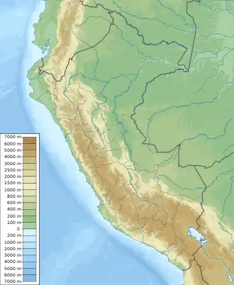
Lake Mitococha[1][2] or Mitucocha[2][3][4] (possibly from Quechua mit'u, mitu mud, qucha lake, "mud lake") is a lake in Peru located in Huanuco Region, Lauricocha Province, Queropalca District.[5] It has an elevation of 4,270 metres (14,009 ft) above sea level.[3] It lies on the east side of the Huayhuash mountain range, northeast of Mituraju and Rondoy.[3] Lake Mitococha is 0.83 km long and 0.3 km at its widest point.
| Lake Mitococha | |
|---|---|
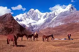 Camp nearby Lake Mitococha | |
 Lake Mitococha | |
| Location | Huanuco Region |
| Coordinates | 10°11′54″S 76°53′42″W |
| Basin countries | Peru |
| Max. length | 0.83 km (0.52 mi) |
| Max. width | 0.3 km (0.19 mi) |
| Surface elevation | 4,270 m (14,010 ft) |
See also
References
- Peru 1:100 000, Yanahuanca (21-j). IGN (Instituto Geográfico Nacional - Perú).
- Biggar, John (2005). The Andes: A Guide for Climbers. Andes. pp. 95, 96. ISBN 9780953608720.
- Alpenvereinskarte 0/3c. Cordillera Huayhuash (Peru). 1:50 000. Oesterreichischer Alpenverein. 2008. ISBN 9783937530079.
- Jackson, Jack (2006). Trekking Atlas of the World. New Holland Publishers. pp. 135, 137. ISBN 9781845371791.
- escale.minedu.gob.pe - Map of the Lauricocha Province (Huanuco Region)
This article is issued from Wikipedia. The text is licensed under Creative Commons - Attribution - Sharealike. Additional terms may apply for the media files.