Lake Puketirini
Lake Puketirini is a former opencast coal mine, immediately to the west of Huntly and east of the larger, but much shallower Lake Waahi, in the Waikato Region. It is circled by a walkway.
| Lake Puketirini | |
|---|---|
| formerly Lake Rotoiti | |
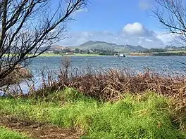
 Lake Puketirini and Hakarimata Range. The old railway station and diving school vessel are across the lake | |
 Lake Puketirini | |
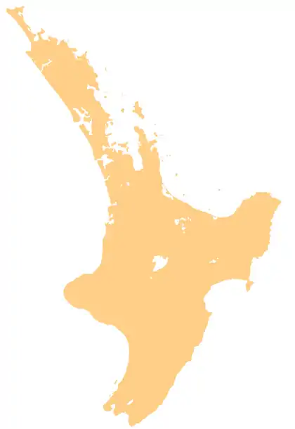
| Location | North Island |
| Coordinates | 37.567°S 175.141°E |
| Type | former opencast mine |
| Basin countries | New Zealand |
| Max. length | 700 m (2,300 ft) |
| Surface area | 54 hectares (130 acres) (open water) |
| Max. depth | 64 metres (210 ft) |
| Settlements | Huntly |
History

The area was initially known as Puketirini, which included Lake Rotoiti,[1] which was shown on maps until 1949,[2] though a 1944 map showed it as Westmere and drained.[3] The west shaft of Ralph Mine was at Puketirini and used for rescue after the 1914 explosion.[4] The site was identified as a potential coal mine in 1929 and land was bought by the government between 1940 and 1980.[1]
Mining began on part of the site in 1954,[5] or 1956. The initial mining used small excavators.[6] From 1984 the mine was extended to the north.[7] It was transferred to the Coal Corporation in 1986 and Weavers opencast coal mine excavated the area until 1993, using a bucketwheel excavator and conveyor belt to dig out 16,000,000 m3 (21,000,000 cu yd) of overburden and 2,300,000 t (2,500,000 tons) of coal, mostly for Glenbrook steelworks.[7] Much of the area around the lake is unconsolidated overburden.[8]
The shoreline was shaped by 1999 and the lake was full by 2005.[1] In December 2006, Waikato District Council acquired[1] part of the site for recreational use[8] from Solid Energy.[1]
Pollution
A 2006 study found the lake was mesotrophic and that koi carp were present.[9]
Coalfields Museum

A 1978 map shows a siding from the Glen Afton branch had been laid.[10] It was on that alignment that, in 2008, the 1939 Huntly railway station was moved, as part of plans to put the Waikato Coalfields Museum beside the lake.[11] In 2017 the museum was further discussed[12] and moved to the centre of Huntly.[13]
Diving School
In 2000 the New Zealand School of Commercial Diver Training opened.[6] It now operates as the Subsea Training Centre.[14]
External links
References
- "Puketirini MANAGEMENT PLAN" (PDF). Waikato District Council. 2009.
- "Sheet: 1". www.mapspast.org.nz. 1949. Retrieved 2020-07-22.
- "Sheet: N56". www.mapspast.org.nz. 1944. Retrieved 2020-07-22.
- "Waikato Coalfields Museum". www.facebook.com. Retrieved 2020-07-22.
- "Weavers Coal Mine (Lake Puketirini), Huntly, Waikato District, Waikato Region, New Zealand". www.mindat.org. Retrieved 2020-07-22.
- "Waikato Coalfields Museum Educational Resource – Teacher's Unit" (PDF).
- Wezenberg, Udo (1988). "An engineering geological investigation of batter stability, Weavers opencast coal mine, Huntly" (PDF). University of Canterbury.
- "Solid Energy Lake Puketirini Rezoning" (PDF). Waikato District Council. 7 June 2017.
- "Lake Puketirini". LERNZ - Lake Ecosystem Research New Zealand. Retrieved 2020-07-23.
- "Sheet: N56". www.mapspast.org.nz. 1978. Retrieved 2020-07-22.
- "Old station in new life at lake". Stuff.co.nz. 11 July 2008. Retrieved 28 May 2017.
- "Agenda for an extraordinary meeting" (PDF). Waikato District Council. 29 March 2017.
- "At the Museum". Waikato Coalfields Museum. Retrieved 2020-07-22.
- "About Us". Subsea Training Centre. Retrieved 2020-07-22.