Land o' Lakes, Florida
Land O' Lakes is a census-designated place (CDP) in Pasco County, Florida, United States. Land O' Lakes is part of the Tampa-St. Petersburg-Clearwater, Florida MSA.
Land O' Lakes, Florida | |
|---|---|
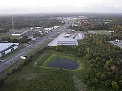 Intersection of U.S. Route 41 and State Road 54 | |
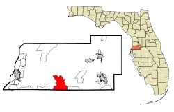 Location in Pasco County and the state of Florida | |
| Coordinates: 28°12′14″N 82°26′56″W | |
| Country | United States |
| State | Florida |
| County | Pasco |
| Area | |
| • Census-designated place | 21.17 sq mi (54.82 km2) |
| • Land | 18.96 sq mi (49.10 km2) |
| • Water | 2.21 sq mi (5.72 km2) |
| Elevation | 75 ft (23 m) |
| Population (2020) | |
| • Census-designated place | 35,929 |
| • Density | 1,895.29/sq mi (731.78/km2) |
| • Metro | 3.8 million |
| Time zone | UTC-5 (Eastern (EST)) |
| • Summer (DST) | UTC-4 (EDT) |
| ZIP code | 34637, 34638, 34639 |
| Area code | 813 |
| FIPS code | 12-39200[2] |
| GNIS feature ID | 0294219[3] |
As of the 2020 United States census, Land O' Lakes had a population of 35,929.
History
The land that is now Land O' Lakes was taken from its Native American inhabitants in the 1830s as part of the Second Seminole War. By the 1840s, a stage coach line ran through the center of where the town is now located. Eventually, by the early 1900s, a railroad line ran through the town and a station was built.[4]
Throughout the 20th century, Land O' Lakes expanded and absorbed surrounding communities such as Denham, Ehren, and Gowers Corner.[5]
Dupree Gardens, one of Florida's original roadside tourist attractions, was located in what is now known as Land O' Lakes. The name Land O' Lakes was suggested at a community meeting in 1949. On September 1, 1950, the Ehren post office was renamed Land O' Lakes.
The CDP grew rapidly during the 1990s, growing from 7,800 residents to 20,971 as new housing developments were built. Average annual income is higher than the rest of Florida.[6] The CDP had a population in 2007 of 30,400 residents.[7]
Demographics
| Census | Pop. | Note | %± |
|---|---|---|---|
| 1980 | 4,515 | — | |
| 1990 | 7,892 | 74.8% | |
| 2000 | 20,971 | 165.7% | |
| 2010 | 31,996 | 52.6% | |
| 2020 | 35,929 | 12.3% | |
| source:[8] | |||
According to the 2020 census,[9] Land O' Lakes had a population of 35,929 with 13,656 households resulting in 2.82 persons per household.
By age the population was split with 5.0% under 5 years old, 22.9% under 18 years old, and 17.1% 65 years or older. 50.8% of the population were female persons.
By race the population was split with 67.2% white (non-Hispanic), 5.7% black or African American, 0.3% American Indian or Alaska Native, 4.1% Asian, 7.4% two or more races, and 20.5% Hispanic or Latino. There were 2,636 veterans living in the CDP and 12.2% of the population were foreign born persons.
The owner-occupied housing rate was 81.6%. The median value of owner-occupied housing units was $269,900. The median monthly owner costs with a mortgage was $1,720 and without a mortgage was $567. The median gross rent was $1,524. 98.5% of households had a computer and 95.1% had a broadband Internet subscription. 94.0% of the population 25 years and older were high school graduates or higher and 35.8% of that same population had a Bachelor's degree or higher. The median household income was $84,146 and the per capita income was $36,877. 8.2% of the population lived below the poverty threshold.
Major roads
 Suncoast Parkway runs north and south along the western edge of Land O' Lakes (actually closer to Odessa).
 U.S. Route 41 (Land O' Lakes Boulevard) is the main north-south road in Land O' Lakes as well as the rest of central Pasco County.
 SR 54 is the main east-west road that runs through southern Pasco County, from US 19 near Holiday to US 301 in Zephyrhills.
 SR 597 (Dale Mabry Highway)
 County Road 583 (Ehren Cutoff) runs northeast to southwest from US 41 to SR 52 in rural Pasco County.
- Collier Parkway
Culture
An honorary mayor position was established by area residents in 1968. The honorary mayor has no real political power and only has ceremonial duties.[10]
The town is a member of the Pasco County Library Cooperative with a library branch, the Land O' Lakes Branch Library, at 2818 Collier Parkway, Land O' Lakes, Florida 34639.
Education
Public district schools are operated by the Pasco County Schools.
High schools
Middle schools
Elementary schools
- Lake Myrtle Elementary School
- Oakstead Elementary School
- Pine View Elementary School
- Denham Oaks Elementary School
- Connerton Elementary School
- Sanders Memorial Elementary School
- Bexley Elementary School
Charter schools
- Countryside Montessori
- Imagine School at Land O Lakes
- Classical Preparatory School
Private schools
- Academy at the Lakes
- Land O Lakes Christian School
- Center Academy Lutz
Notable companies
Points of interest
- Conner Preserve
- Cypress Creek Preserve
- Dupree Gardens (Historical marker and gate ruins)
References
- "2020 U.S. Gazetteer Files". United States Census Bureau. Retrieved October 31, 2021.
- "U.S. Census website". United States Census Bureau. Retrieved January 31, 2008.
- "US Board on Geographic Names". United States Geological Survey. October 25, 2007. Retrieved January 31, 2008.
- Bedard, Diane. "Developing Land O'Lakes". NatureCoaster. Retrieved June 19, 2023.
- Cannon, Jeff. "What's In A Name: Denham Oaks Elementary School". Retrieved June 19, 2023.
- "Land O' Lakes, Florida (FL 33559, 34638) profile: population, maps, real estate, averages, homes, statistics, relocation, travel, jobs, hospitals, schools, crime, moving, houses, news, sex offenders". www.city-data.com.
- Money Magazine 2007 Archived April 3, 2010, at the Wayback Machine
- "CENSUS OF POPULATION AND HOUSING (1790-2000)". U.S. Census Bureau. Retrieved July 18, 2010.
- "QuickFacts Land O' Lakes CDP, Florida". www.census.gov. United States Census Bureau. Retrieved June 19, 2023.
- Sullivan, Erin. "A mayor, but not actually mayoral." St. Petersburg Times. November 2, 2006. Retrieved on March 19, 2014.
External links
Municipalities and communities of Pasco County, Florida, United States | ||
|---|---|---|
| Cities | 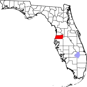 | |
| Town | ||
| CDPs |
| |
| Unincorporated communities | ||
| Ghost towns | ||
| Footnotes | ‡This populated place also has portions in an adjacent county or counties | |