Langley Moor
Langley Moor is an old pit village in County Durham, England. It is located approximately 2 miles south-west of Durham City. Langley Moor is within the civil parish of Brandon and Byshottles which is itself within the City of Durham constituency, as of 2019 represented by Mary Foy MP.
| Langley Moor | |
|---|---|
 | |
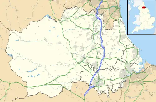
 Langley Moor Location within County Durham | |
| Population | 1,675 (2011 census) |
| OS grid reference | NZ2521840458 |
| Civil parish | |
| Unitary authority | |
| Ceremonial county | |
| Region | |
| Country | England |
| Sovereign state | United Kingdom |
| Post town | DURHAM |
| Postcode district | DH7 |
| Dialling code | 0191 |
| Police | Durham |
| Fire | County Durham and Darlington |
| Ambulance | North East |
| UK Parliament | |
History
The village consists of a large park, three pubs, three schools, a church and an industrial estate.
Holliday Park (previously Bents Park, known locally as Boyne Park after Lord Boyne) is located to the north of the village, and was renovated in 2016 with a new children's play area. [1] The park also provides access to the River Browney which runs through it. The park was donated to the public by local alderman and philanthropist Martin Forster Holliday (1848-1935), [2] who was the manager and agent for three North Brancepeth Coal Company collieries (Broompark, Boyne and Littleburn - the latter two being in the village) from 1884 until 1922. [2]
The three pubs in the village are The Station, The New Cross (formerly The Langley Moor Hotel, as of 2022 currently closed) and The Lord Boyne Hotel. Historically, the village had two inns, the Littleburn Hotel, two more pubs, two cinemas, a working men's club (now residential flats), a post office, a bank and Salvation Army barracks. [3][4]
The East Coast Main Line, one of Britain's arterial rail links, runs directly through the village over the high street.
Langley Moor is also home to two supermarkets, a Tesco Metro (formerly Safeway, Somerfield) and Lidl.
Geography
The village is located on the A690 approximately 2 miles south-west of Durham and approximately 15 miles south of Newcastle-upon-Tyne.
The Brandon - Bishop Auckland Railway Path is a rail trail stretching nine-miles of scenic woodland which follows the route of the former Durham to Bishop Auckland Line and runs through Langley Moor. [5]
Education
There are three schools in Langley Moor, two primary schools and one nursery school:
Religion
The church, St. Patrick's Roman Catholic Church, is located on the border with Meadowfield, which opened on 8th October 1911. [10] The estimated cost of the church was £3,000 (which equals £376,523.30 as of May 2022). [10]
Historically, Langley Moor had a methodist church, a Wesleyan church, a baptist church and a United Methodist church. [3][4]
Industry
Littleburn Industrial Estate is home to Harrison & Harrison organ builders, who have been involved with organs in cathedrals and churches across the globe.
Boyne Colliery
Boyne Colliery opened in approximately 1864 under the ownership of W. Mickle and James Snowball, [11] coal was struck the following year. [12] It was sold to the North Brancepeth Coal Company in the 1880s, under the management of John L. Morland from 1880 until 1884. That same year Martin F. Holliday became agent and manager of the colliery until it closed at some point after 1890. [13]
Littleburn Colliery (also known as North Brancepeth Colliery)
Littleburn Colliery opened in approximately 1840, it had a handful of owners including North Brancepeth Coal Company, who bought the colliery in the 1880s. In 1925, at its peak, the pit employed 779 people. The colliery mined coal throughout its operational life. Martin F. Holliday became agent of the colliery in 1909 until his retirement in 1922. Littleburn Colliery closed in December 1950. [14]
References
- "Official opening of new play equipment at Holliday Park". Friends of Langley Moor. 20 April 2016. Archived from the original on 17 April 2021. Retrieved 5 May 2022.
- "Durham Mining Museum - Martin Forster Holliday". www.dmm.org.uk. Archived from the original on 20 November 2008. Retrieved 5 May 2022.
- "View map: Durham XXVI.8 (Brandon And Byshottles; Durham) - Ordnance Survey 25 inch England and Wales, 1841-1952". maps.nls.uk. Archived from the original on 6 May 2022. Retrieved 6 May 2022.
- "View map: Durham XXVI.8 (Brandon And Byshottles; Durham) - Ordnance Survey 25 inch England and Wales, 1841-1952". maps.nls.uk. Archived from the original on 6 May 2022. Retrieved 6 May 2022.
- "Long Distance Walkers Association". www.ldwa.org.uk. Archived from the original on 19 April 2022. Retrieved 6 May 2022.
- "Langley Moor Nursery School". Langley Moor Nursery School. Archived from the original on 14 June 2021. Retrieved 6 May 2022.
- "Catalogue Item". 15 December 2016. Archived from the original on 19 May 2022. Retrieved 19 May 2022.
{{cite journal}}: Cite journal requires|journal=(help) - "Langley Moor Primary School - Home". langleymoor-durham.secure-dbprimary.com. Archived from the original on 16 March 2022. Retrieved 6 May 2022.
- "St Patrick's Primary School, Langley Moor". St Patrick's Primary School, Langley Moor. Archived from the original on 18 June 2021. Retrieved 6 May 2022.
- "History – St. Patrick's RC Church". Archived from the original on 21 June 2021. Retrieved 6 May 2022.
- "TO SINKERS". Newcastle Journal. 11 November 1864. Retrieved 6 May 2022.
- "Boyne Pit Coal". Durham County Advertiser. 5 May 1865. Retrieved 6 May 2022.
- "Durham Mining Museum - Boyne Colliery". www.dmm.org.uk. Archived from the original on 6 May 2022. Retrieved 6 May 2022.
- "Durham Mining Museum - Littleburn Colliery". www.dmm.org.uk. Archived from the original on 6 May 2022. Retrieved 6 May 2022.
External links
- Durham County Council (Brandon - Bishop Auckland Railway Path)
 Media related to Langley Moor at Wikimedia Commons