Lantau Link
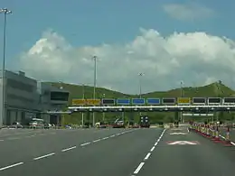
The Lantau Link, formerly known as the Lantau Fixed Crossing,[1] is a roadway in Hong Kong forming part of Route 8 linking Lantau Island to Tsing Yi, from which other roads lead to the urban areas of Kowloon and the rest of the New Territories. Part of the Airport Core Programme centred on the new Hong Kong International Airport on Lantau, the link was officially opened on 27 April 1997, and it opened to traffic on 22 May the same year.[1]
 | |
|---|---|
| Part of Route 8 | |
| Route information | |
| Maintained by Highways Department | |
| Length | 4.0 km (2.5 mi) |
| Existed | 27 April 1997–present |
| Major junctions | |
| East end | Tsing Yi |
| 3; | |
| West end | Lantau (near Tsing Chau Tsai) |
| Location | |
| Country | China |
| Special administrative region | Hong Kong |
| Highway system | |
| Lantau Link | |||||||||||
|---|---|---|---|---|---|---|---|---|---|---|---|
| Traditional Chinese | 青嶼幹線 | ||||||||||
| Simplified Chinese | 青屿干线 | ||||||||||
| |||||||||||


Infrastructure
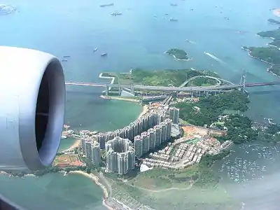
The Lantau Link is 3.5 kilometres (2.2 mi) long and consists of:
- the Tsing Ma Bridge, a suspension bridge linking Tsing Yi to Ma Wan island
- the Ma Wan Viaduct, a viaduct crossing Ma Wan
- the Kap Shui Mun Bridge, a cable-stayed bridge linking Ma Wan to Lantau Island
Link is split into two traffic levels; the upper level is an open, 3-lane divided highway, while the lower level is a double-track railway line used by the MTR Airport Express and Tung Chung line and also contains two single-lane roads for emergency use in both directions. The speed limit is 80 kilometres per hour (50 mph) on the upper level and 50 kilometres per hour (31 mph) on the lower level. In normal situations, the lower level is not used except in special circumstances such as strong wind or serious accidents which could lead to the closure of the upper level. The lower level is not connected to Ma Wan.
The Lantau Link is one of the two land passageway connecting Lantau and other parts of Hong Kong; Tuen Mun–Chek Lap Kok Link via Tuen Mun has opened on 27 December 2020 as the second land connection, reducing the traffic pressure on Lantau Link.[2]
Near the Tsing Yi end of the Lantau Link is the cable-stayed Ting Kau Bridge, and the Cheung Tsing and Nam Wan Tunnels, the latter of which leads to the Stonecutters Bridge.
Interchanges
| Lantau Link | ||
| Inbound exits | Exit number | Lantau-bound exits |
| End Lantau Link continues as Tsing Sha Highway |
- | Start Lantau Link |
| Cheung Tsing Highway Container Terminals 1-7, Kowloon, Hong Kong |
4A | no exit |
| Tsing Long Highway Yuen Long, Tuen Mun |
4B | no exit |
| Tsing Ma Bridge | ||
| Ma Wan Viaduct | ||
| no exit | 4C | Ma Wan Road Ma Wan enter by permit only |
| Kap Shui Mun Bridge | ||
| Start Lantau Link | - | End Lantau Link continues as North Lantau Highway |
References
- Government information about the Lantau Link
- "Tolls of Lantau Link to be waived from 0.00am on December 27". Hong Kong Government. 21 December 2020. Retrieved 28 July 2021.
External links
| Preceded by Tsing Sha Highway |
Hong Kong Route 8 Lantau Link |
Succeeded by North Lantau Highway |