Lewis Shale
The Lewis Shale is a geologic formation in the Western United States. It preserves fossils dating back to the Campanian to Maastrichtian stages of the late Cretaceous period.
| Lewis Shale | |
|---|---|
| Stratigraphic range: | |
 Lewis Shale in road cut in the type area, La Plata valley, Colorado | |
| Type | Formation |
| Sub-units | Dad Sandstone Member, Huerfanito Bentonite Bed, Teckla Sandstone Member. |
| Underlies | Pictured Cliffs Formation |
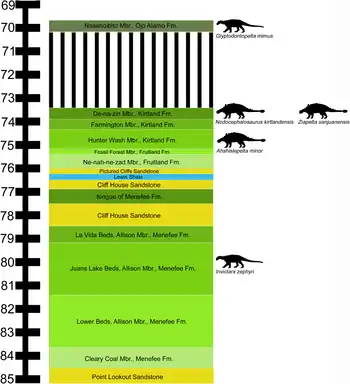
| Overlies | Mesaverde Group |
| Thickness | 600 m |
| Lithology | |
| Primary | Shale |
| Other | Sandstone |
| Location | |
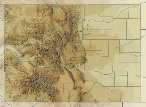
| Coordinates | 37.215°N 108.006°W |
| Region | Mountain states, United States |
| Country | |
| Type section | |
| Named for | Fort Lewis (former Army installation in La Plata County, Colorado) |
| Named by | Charles Whitman Cross, A.C. Spencer, and C.W. Purington |
 Lewis Shale (the United States)  Lewis Shale (Colorado) | |

Description

The Lewis Shale is an olive-gray marine shale with some thin beds of claystone, siltstone, sandstone, and limestone. It was deposited in the Western Interior Seaway in the late Cretaceous.[1] The formation crops out in the Bighorn Basin, Green River Basin, Powder River Basin, San Juan Basin, and Wind River Basin.
In the San Juan Basin, the formation has a maximum thickness of over 600 meters (2,000 ft)[2] in the northern part of the basin, but pinches out in the southern part of the basin.[3] It is the stratigraphically highest marine shale in the basin, and is a sandy siltstone rather than a true shale.[4] The upper part of the formation contains the Huerfanito Bentonite Bed, long recognized in the subsurface but recently discovered to crop out near Regina, New Mexico. The bed lies in the upper Baculites scottii biostratigraphic zone and has a radiometric age of 75.76 ± 0.34 million years.[5]
In the Green River Basin, the formation is also up to 600 meters thick and is divided into upper and lower shale members by the Dad Sandstone Member.[6] The Dad Sandstone Member contains hyperpycnites, sediments deposited by floodwater from a river delta that contains so much sediment that it is more dense than seawater and behaves as a sustained turbidity current.[7] This is consistent with deposition of the Lewis Shale as submarine fans deposited in advance of a prograding shoreline.[8]
Fossils
The formation is relatively poor in fossils.[1] However, the formation contains fossils of the ammonites Baculites clinolobatus,[9] Baculites asper,[2] and Rhaeboceras.[10]
Economic geology
The Lewis Shale in the San Juan Basin has historically been a minor source of natural gas. However, there is growing interest in increasing the production of this formation via hydraulic fracturing. While only sixteen wells were completed into the Lewis Shale before 1990, there were over 101 well completions by 1997.[11]
"Dry frac", a form of hydraulic fracturing using carbon dioxide and sand rather than aqueous fracturing fluids, has been tested in the Lewis Shale of the San Juan Basin.[12]
History of investigation
The formation was named by Charles Whitman Cross, A.C. Spencer, and C.W. Purington in 1899 for outcrops near Fort Lewis, Colorado.[2]
Footnotes
References
- Beaumont, E.C.; Dane, C.H.; Sears, J.D. (1956). "Revised nomenclature of Mesaverde group in San Juan basin, New Mexico". American Association of Petroleum Geologists Bulletin. 40 (9): 2149–2162. doi:10.1306/5CEAE565-16BB-11D7-8645000102C1865D.
- Campbell, S.M.; Fairchild, N.R.; Arnold, D.L. (12 March 2000). "Liquid CO2 and Sand Stimulations in the Lewis Shale, San Juan Basin, New Mexico: A Case Study". All Days: SPE–60317–MS. doi:10.2118/60317-MS.
- Dube, H.G.; Christiansen, G.E.; Frantz, J.H.; Fairchild, N.R.; Olszewski, A.J.; Sawyer, W.K.; Williamson, J.R. (1 October 2000). "The Lewis Shale, San Juan Basin: What We Know Now". All Days: SPE–63091–MS. doi:10.2118/63091-MS.
- Cobban, W.A. (1988). "The Upper Cretaceous ammonite Rhaeboceras Meek in the Western Interior of the United States". U.S. Geological Survey Professional Paper. Professional Paper. 1477. doi:10.3133/pp1477.
- Cross, Whitman; Spencer, A.C.; Purington, C.W. (1899). "La Plata folio, Colorado". Geologic Atlas of the United States. GF-60.
- Dubiel, R.F. (2013). "Geology, sequence stratigraphy, and oil and gas assessment of the Lewis Shale Total Petroleum System, San Juan Basin, New Mexico and Colorado". U.S. Geological Survey Digital Data Series. 69–F: 1–45. doi:10.3133/ds69F5.
- Fassett, James E.; Cobban, William A.; Obradovich, John D. (1997). "Biostratigraphic and isotopic age of the Huerfanito bentonite bed of the upper Cretaceous Lewis Shale at an outcrop near Regina, New Mexico" (PDF). New Mexico Geological Society Field Conference Series. 48: 229–232. Retrieved 15 September 2021.
- Hale, L.A. (1961). "Late Cretaceous (Montanan) stratigraphy eastern Washakie basin, Carbon County, Wyoming". Wyoming Geological Association Field Conference Guidebook. 16: 129–137.
- Pyles, David R.; Slatt, Roger M. (2007). "Chapter 154: Applications to Understanding Shelf Edge to Base-of-slope Changes in Stratigraphic Architecture of Prograding Basin Margins: Stratigraphy of the Lewis Shale, Wyoming, USA". AAPG Studies in Geology. 56. Retrieved 15 September 2021.
- "Lewis Shale". Chaco Culture National Historical Park, New Mexico. National Park Service. 2015. Retrieved 8 June 2020.
- Roehler, H.W. (1993). "Stratigraphy of the Upper Cretaceous Fox Hills Sandstone and adjacent parts of the Lewis Shale and Lance Formation, east flank of the Rock Springs uplift, southwest Wyoming". U.S. Geological Survey Professional Paper. Professional Paper. 1532. doi:10.3133/pp1532.
- Soyinka, Olatundo A.; Slatt, Roger M. (31 January 2008). "Identification and micro-stratigraphy of hyperpycnites and turbidites in Cretaceous Lewis Shale, Wyoming: Hyperpycnites and turbidites". Sedimentology. 55 (5): 1117–1133. doi:10.1111/j.1365-3091.2007.00938.x. S2CID 129897873.