Libertador Municipality, Monagas
Libertador is one of the 13 municipalities of the state of Monagas, Venezuela. The municipality's capital is Temblador.
Libertador Municipality
Municipio Libertador | |
|---|---|
 Flag | |
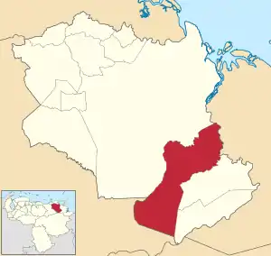 Location in Monagas | |
.svg.png.webp) Libertador Municipality Location in Venezuela | |
| Coordinates: 9°04′25″N 62°35′21″W | |
| Country | |
| State | Monagas |
| Government | |
| • Mayor | Miguel Presilla (PCV) |
| Area | |
| • Total | 3,238.4 km2 (1,250.4 sq mi) |
| Population (2011) | |
| • Total | 53,917 |
| • Density | 17/km2 (43/sq mi) |
| Time zone | UTC−4 (VET) |
| Website | Official website |
Geography
Libertador Municipality is located to the southwest of Monagas State. Its vegetation is tropical dry forest, with average annual temperature of 27.1°C and average annual precipitation of 1,000 mm. Among the main watercourses are Caño Mánamo and the Morichal Largo River.
Economy
The economy is based on agriculture and forestry (primarily pine plantations).
Culture
The indigenous Warao people live in Libertador Municipality. They speak Warao, an agglutinative language isolate.
Cuisine
A typical dish of this region is Soup of Ocumo, prepared with banana, jojoto and leaf sprouts of ocumo (Xanthosoma).
Public holidays
On September 8, the region celebrates the day of the Virgin of the Valley, patron of the east of Venezuela.
Mayor
- Miguel Presilla (2017 - 2021) PCV.