Lidsdale
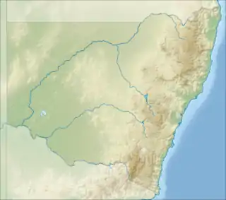
Lidsdale is a locality within the City of Lithgow Local Government Area of New South Wales, Australia. It lies to the north of Wallerawang. Its area, as defined for postal and statistical purposes, includes the historic locality of Kerosene Vale and the small rural areas known as Springvale and Angus Place. In 2021, its population was 471.[1]
| Lidsdale New South Wales | |||||||||||||||
|---|---|---|---|---|---|---|---|---|---|---|---|---|---|---|---|
 Lidsdale | |||||||||||||||
| Coordinates | 33°23′24″S 150°05′05″E | ||||||||||||||
| Population | 471 (2021) | ||||||||||||||
| Postcode(s) | 2790 | ||||||||||||||
| Location | |||||||||||||||
| LGA(s) | City of Lithgow | ||||||||||||||
| Region | Central Tablelands | ||||||||||||||
| County | Australia | ||||||||||||||
| State electorate(s) | Bathurst | ||||||||||||||
| Federal division(s) | Calare | ||||||||||||||
| |||||||||||||||
The area that later became known as Lidsdale lies close to the easternmost extent of the traditional lands of Wiradjuri people.[2] There are culturally significant sites within the locality.[3]
A village developed as a stopping place on the road to Mudgee during the gold rushes. It soon had at least two inns, the Carriers Arms and the Square and Compass Inn, also a livery stable and blacksmith's shop.[4]
Coal mining began in the area, in 1893, when the Folly mine was opened by John Maddox, a son of the owner of the Carrier's Arms inn, Thomas Maddox.[5][6] Coal mining still takes place in Lidsdale.[7] There was also a short-lived oil shale mining, retorting and shale oil refining operation, in the part of the locality that was formerly known as Kerosene Vale, beginning in 1867.[8][9][10]
Most of the settled area of the locality is in the mainly-cleared valley of Coxs River. At the southern end, is the small village, centred on Wolgan Road, which is now an area of mixed industrial and residential use. The southern boundary of the locality borders the site of the former Wallerawang Power Station.[11] There are two coal mines, Angus Place mine (closed)[12] and Springvale mine.[7] There is a large ash dam and dry ash dump, in the part of the locality that was formerly known as Kerosene Vale.[13][14] The locality extends north to the Wolgan Gap, the location where Wolgan Road descends into the Wolgan Valley, and to part of the valley's rim. Most of the eastern part of the locality is forested and mountainous.[11]
In the past, the village area in the south of the locality lay on the main road between Lithgow and Mudgee, which intersected Wolgan Road,[15] but the Castlereagh Highway now bypasses it, where it runs across the south-western part of the locality. Part of the former Wallerawang Colliery Branch Railway ran through the locality and serviced the Angus Place mine.[16] The Main Western railway line passes across the south-east part of the locality, in the area known as Springvale.[17]
Lidsdale had a post office, which opened in 1871, originally as Wallerawang, and was renamed Lidsdale, in 1873, after another post office opened closer to the Wallerawang railway station and township. The existing building opened in 1912; it closed in November 1991, and subsequently has been converted to holiday accommodation.[18] It had a school for most of the time between August 1870 and June 1936, and again January 1963 between May 1975; the school was known as Lidsdale only between 1900 and 1936 and otherwise mainly used the name Blackmans Flat.[19]
References
- "2021 Lidsdale, Census All persons QuickStats | Australian Bureau of Statistics". www.abs.gov.au. Retrieved 15 August 2023.
- Australian Institute of Aboriginal and Torres Strait Islander Studies (25 May 2022). "Map of Indigenous Australia". aiatsis.gov.au. Retrieved 5 June 2022.
- "Black Fellows Hands Reserve (Maiyingu Marragu) | Lithgow Tourism Information". 22 September 2017. Retrieved 15 August 2023.
- "HISTORICAL SUMMARY". lithgow-tourism.com. Retrieved 16 August 2023.
- "LIDSDALE COAL AND SHALE". Lithgow Mercury. 24 January 1923. p. 1. Retrieved 18 August 2023.
- "FOLLY COLLIERY". New South Wales Government Gazette. 8 February 1895. p. 846. Retrieved 18 August 2023.
- "Springvale coal mine". Global Energy Monitor. 13 June 2022. Retrieved 15 August 2023.
- "Geological map (with sections) showing position of kerosene shale seam at Marangaroo, Kerosene Vale or Bathgate". Trove. Retrieved 5 June 2022.
- "MACKENZIE AND BROS. KEROSENE WORKS". Maitland Mercury and Hunter River General Advertiser. 15 January 1867. p. 3. Retrieved 5 June 2022.
- "TOWN AND COUNTRY, Kerosene Vale Oil Works". Sydney Mail. 1 June 1867. p. 2. Retrieved 5 June 2022.
- "Satellite View - Lidsdale · New South Wales 2790, Australia". Google Maps. Retrieved 16 August 2023.
- "Angus Place Colliery". Global Energy Monitor. 31 March 2023. Retrieved 15 August 2023.
- "Kerosene Vale". www.bushexplorers.com.au. Retrieved 5 June 2022.
- Parsons Brinckerhoff (April 2008). "Stage 2 - Kerosene Vale Ash Repository Area, Environmental Assessment" (PDF).
- "Blue Mountains and Burragorang Valley tourist map [cartographic material]". Trove. Retrieved 15 August 2023.
- "Wallerawang Colliery Branch". www.nswrail.net. Retrieved 15 August 2023.
- "Relation: Lidsdale (6044563)". OpenStreetMap. Retrieved 25 August 2023.
- "The Old Postie, Lidsdale - Wolgan Valley". Wolgan Valley Association. Retrieved 15 August 2023.
- "Lidsdale". nswgovschoolhistory.cese.nsw.gov.au. Retrieved 15 August 2023.