Lin Ma Hang Road
Lin Ma Hang Road (Chinese: 蓮麻坑路) is one of the northernmost roads in Hong Kong. Most of the road was built along the border with mainland China along the Sham Chun River.
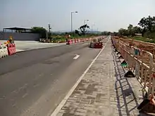
Lin Ma Hang Road near Ta Kwu Ling
The road spans from Man Kam To to Sha Tau Kok. The entire length of the road fell within the Frontier Closed Area until 4 January 2016. Currently, about 6.2 kilometres (3.9 mi) of the 13.2 kilometres (8.2 mi) long road near Lin Ma Hang and Sha Tau Kok is inaccessible.[1][2] As of March 2016, the road is undergoing widening construction.[3][4][5]
See also
References
- "蓮麻坑解禁 路窄存隱憂". Retrieved 29 March 2016.
- "新界東北邊境"破禁" 成探祕新景點". Retrieved 29 March 2016.
- "蓮麻坑路西段及東段擴闊工程是甚麼?目的為何?". Retrieved 29 March 2016.
- "Lin Ma Hang road on Google Maps". Retrieved 29 March 2016.
- "Lin Ma Hang Road widening gazetted". Retrieved 29 March 2016.
Wikimedia Commons has media related to Lin Ma Hang Road.
This article is issued from Wikipedia. The text is licensed under Creative Commons - Attribution - Sharealike. Additional terms may apply for the media files.