Lingewaal
Lingewaal (Dutch pronunciation: [ˌlɪŋəˈʋaːl] ⓘ) is a former municipality of the Netherlands.
Lingewaal | |
|---|---|
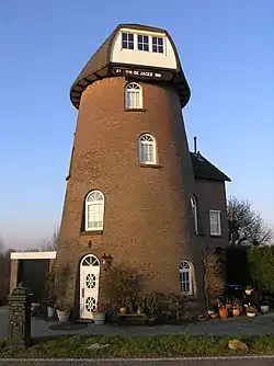 Former windmill in Herwijnen | |
 Flag  Coat of arms | |
.svg.png.webp) Location in Gelderland | |
| Coordinates: 51°53′N 5°7′E | |
| Country | Netherlands |
| Province | Gelderland |
| Municipality | West Betuwe |
| Established | 1 January 1986 |
| Merged | 2019 |
| Area | |
| • Total | 54.49 km2 (21.04 sq mi) |
| • Land | 50.44 km2 (19.47 sq mi) |
| • Water | 4.05 km2 (1.56 sq mi) |
| Elevation | 2 m (7 ft) |
| Population (January 2021)[3] | |
| • Total | data missing |
| Time zone | UTC+1 (CET) |
| • Summer (DST) | UTC+2 (CEST) |
| Postcode | Parts of 4100 and 4200 ranges |
| Area code | 0183, 0345, 0418 |
| Website | www |
On 1 January 2019, it merged with Geldermalsen and Neerijnen to form the new municipality of West Betuwe.
Topography
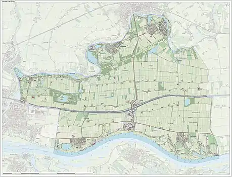
Dutch topographic map of the municipality of Lingewaal, June 2015
References
- "Kerncijfers wijken en buurten 2020" [Key figures for neighbourhoods 2020]. StatLine (in Dutch). CBS. 24 July 2020. Retrieved 19 September 2020.
- "Postcodetool for 4147AN". Actueel Hoogtebestand Nederland (in Dutch). Het Waterschapshuis. Archived from the original on 21 September 2013. Retrieved 8 July 2014.
- "Bevolkingsontwikkeling; regio per maand" [Population growth; regions per month]. CBS Statline (in Dutch). CBS. 1 January 2021. Retrieved 2 January 2022.
External links
 Media related to Lingewaal at Wikimedia Commons
- Official website
Places adjacent to Lingewaal | ||||||||||||||||
|---|---|---|---|---|---|---|---|---|---|---|---|---|---|---|---|---|
| ||||||||||||||||
This article is issued from Wikipedia. The text is licensed under Creative Commons - Attribution - Sharealike. Additional terms may apply for the media files.