List of Local Government Areas in Yobe State
Yobe was created on 27 August 1991. It is a mainly agricultural state, and it is a state located in northeastern Nigeria.[4] Yobe State was carved out of Borno State. The capital of Yobe State is Damaturu; its largest and most populated city is Potiskum.
Yobe | |
|---|---|
 Flag  Seal | |
| Nicknames: | |
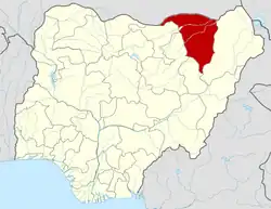 Location of Yobe State in Nigeria | |
| Coordinates: 12°00′N 11°30′E | |
| Country | |
| Date created | 27 August 1991 |
| Capital | Damaturu |
| Government | |
| • Body | Government of Yobe State |
| • Governor (List) | Mai Mala Buni (APC) |
| • Deputy Governor | Idi Barde Gubana (APC) |
| • Legislature | Yobe State House of Assembly |
| • Senators | C: Ibrahim Gaidam (APC) N: Ahmed Lawan (APC) S: Ibrahim Mohammed Bomai (APC) |
| • Representatives | List |
| Area | |
| • Total | 45,502 km2 (17,568 sq mi) |
| • Rank | 6th of 36 |
| Population (2006 census) | |
| • Total | 2,321,339[1] |
| • Estimate (2021) | 4,000,000 |
| • Rank | 32nd of 36 |
| GDP (PPP) | |
| • Year | 2023 |
| • Total | $8.3 billion[2] |
| • Per capita | $2,190[2] |
| Time zone | UTC+01 (WAT) |
| postal code | 620001 |
| Area code | +234 |
| ISO 3166 code | NG-YO |
| HDI (2018) | 0.365[3] low · 35th of 37 |
LGAs
Yobe State consists of 17 local government areas (or LGAs).[5][6] They are:
External links
References
- "2006 PHC Priority Tables – NATIONAL POPULATION COMMISSION". population.gov.ng. Retrieved 10 October 2017.
- "TelluBase: Nigeria Extract" (PDF). Tellusant. Retrieved 1 June 2023.
- "Sub-national HDI - Area Database - Global Data Lab". hdi.globaldatalab.org. Retrieved 13 September 2018.
- "Yobe State of Nigeria :: Nigeria Information & Guide". www.nigeriagalleria.com. Retrieved 11 November 2022.
- "Yobe State". Nigerian Investment Promotion Commission. 9 January 2019. Retrieved 11 November 2022.
- Admin (23 February 2019). "Local Government Areas in Yobe State". Nigeria Postcode. Retrieved 11 November 2022.
This article is issued from Wikipedia. The text is licensed under Creative Commons - Attribution - Sharealike. Additional terms may apply for the media files.