List of neighbourhoods in Calgary
This is a list of neighbourhoods in Calgary, Alberta.

As of 2016, Calgary has 197 neighbourhoods, which are referred to as "communities" by the municipal government,[1] and 42 industrial areas.[2] A further 15 communities were included in the civic censuses from 2015 to 2019,[3] bringing the total to 212. Calgary Open Data also confirms six more communities yet to be developed (Alpine Park, Ambleton, Glacier Ridge, Lewisburg, TwinHills, and Symons Valley Ranch).[4]
Centre City
The area collectively known as the Centre City comprises Downtown (including the Downtown West End and Downtown East Village) and the adjacent neighbourhoods of Eau Claire, Chinatown, and the Beltline (including Connaught and Victoria Park).[5][6]
Within Centre City, those neighbourhoods below that have an area redevelopment plan (ARP) in effect[7] are indicated with "ARP" in parentheses.
Downtown
Downtown Calgary is bordered by 11th Street W. on the west, 3rd Avenue S. and the Bow River on the north, the Elbow River on the east and the CPR mainline tracks on the south.
Downtown neighbourhoods:
Unofficial districts:[9]
- Stephen Avenue Retail Core
- Entertainment District
- Government District
Other
The remaining Centre City neighbourhoods are predominantly residential and mixed-use. These areas are often considered to be an extension of downtown. Other Centre City neighbourhoods include:
- Beltline — is physically separated from downtown proper by the CPR mainline tracks, and is the densest and most populous neighbourhood in Calgary. It comprises the former neighbourhoods of Connaught on the west and Victoria Park on the east.
- Chinatown[10]
- Eau Claire
Inner city
The inner city includes Downtown Calgary and the adjoining communities, and overlays roughly the city limits before 1961. It is delimited by Sarcee Trail to the west; Glenmore Reservoir and Glenmore Trail to the south; Bow River and Deerfoot Trail to the east; and Bow River and 32 Avenue to the north.[11]
The inner city includes the following neighbourhoods (by city quadrant):
Quadrants
Calgary is divided into four geographic quadrants generally described below.[12]
- Northwest Calgary – west of a combination of Centre Street/Harvest Hills Boulevard and north of a combination of the Bow River, Sarcee Trail and Highway 1 (Trans-Canada Highway)
- Northeast Calgary – east of a combination of Centre Street//Harvest Hills Boulevard and north of a combination of the Bow River, a Canadian Pacific Kansas City rail line, Centre Avenue and Memorial Drive
- Southwest Calgary – south of a combination of the Bow River, Sarcee Trail and Highway 1 (Trans-Canada Highway) and west of a combination of Centre Street, a Canadian Pacific Kansas City rail line, Macleod Trail and Sheriff King Street
- Southeast Calgary – south of a combination of the Bow River, a Canadian Pacific Kansas City rail line, Centre Avenue and Memorial Drive and east of a combination of Centre Street, a Canadian Pacific Kansas City rail line, Macleod Trail and Sheriff King Street
List
The following is a list of all neighbourhoods within the City of Calgary including residential communities, industrial areas, major parks and residual areas by electoral ward.[13]
Business Improvement Areas
Calgary's Business Improvement Areas (BIA; formerly Business Revitalization Zones or BRZ) are business districts established by businesses within an area to jointly raise and administer funds for various projects and promotional activities within that zone throughout the year.[18] BIAs in Calgary are established for one or more of the following purposes: "improving, beautifying and maintaining property" in the BIA; "developing, improving and maintaining public parking;" and/or promoting the BIA as a business or shopping area.[19]
The BRZ program in Calgary was established in 1983 to allow certain commercial areas of the city to administer and promote themselves internally. Many of the zones that emerged from this have since acquired a virtual "neighbourhood" status by the people of Calgary. (None of these zones are officially designated as neighbourhoods unto themselves, however.)
These are the 15 Business Improvement Areas of Calgary as of 2022:[19]
- 17th Ave Retail & Entertainment District
- 4th Street South West BIA (located mostly within Mission)
- Beltline BIA
- Bridgeland BIA
- Calgary Downtown Association
- Chinatown BIA
- Crescent Heights Village BIA
- Greenview Industrial BIA (formerly HIPville BIA)
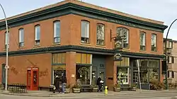
- Inglewood
- International Avenue
- Kensington BIA[20]
- Mainstreet Bowness BIA
- Marda Loop BIA
- Montgomery on the Bow BIA
- Victoria Park BIA
Industrial areas
Most industrial areas are located between Deerfoot Trail and 36 Street East in the northern half of the city; between Macleod Trail, Deerfoot Trail and Glenmore Trail in the south and east of Barlow Trail in the southeast.[21]
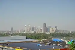
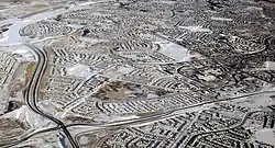
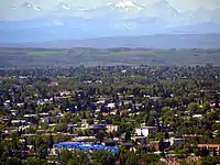
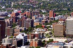
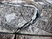
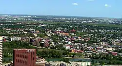
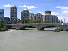
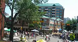
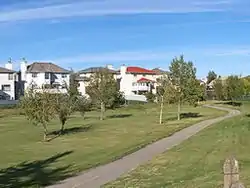
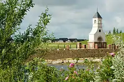
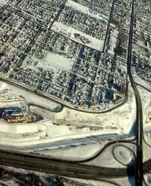
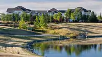
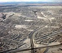
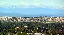
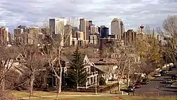
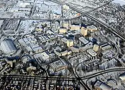
Gallery
See also
- Calgary (main article)
- List of neighbourhoods in Edmonton
References
- "Community Profiles". City of Calgary. 2016. Retrieved 4 October 2020.
- "Community Points". Calgary Open Data. September 2020. Retrieved 4 October 2020.
- "Past Census Results". City of Calgary. 2019. Retrieved 4 October 2020.
- "Community Points". Calgary Open Data. September 2020. Retrieved 4 October 2020.
- Planning & Development. "Centre City". calgary.ca. Retrieved 1 August 2022.
- "Calgary's Centre City". City of Calgary. 15 June 2011. Archived from the original on 18 June 2011. Retrieved 6 July 2011.
- City of Calgary. "Community & Area Plans". Archived from the original on 15 April 2007. Retrieved 23 May 2007.
- ARP
- Downtown Calgary Association (2005). "Downtown Districts". Archived from the original on 6 October 2007. Retrieved 7 May 2007.
- ARP
- Calgary MLS Zone Maps. "Calgary Inner City Communities Map". Archived from the original on 30 May 2007. Retrieved 22 May 2007.
- Innovation, Corporate Analytics and. "Calgary Administrative Boundaries Map". maps.calgary.ca. Retrieved 17 April 2018.
- "2019 Civic Census Results" (PDF). City of Calgary. 2019. Retrieved 2 November 2021.
- "Community Boundaries" (Esri shapefile). City of Calgary. Retrieved 4 July 2012.
- "2013 Civic Census Results" (PDF). City of Calgary. 2013. Retrieved 19 October 2013.
- "Report to the Calgary Planning Commission (CPC2013-025)" (PDF). City of Calgary. 17 January 2013. Retrieved 22 February 2013.
- "Report to the Calgary Planning Commission (CPC2013-050)" (PDF). City of Calgary. January 2013. Retrieved 26 June 2013.
- Information, General. "Business Improvement Area (BIA) Assessment". calgary.ca. Retrieved 31 July 2022.
- "Business Improvement Areas in Calgary". calgary.ca. Retrieved 31 July 2022.
- "About Us | Kensington". Retrieved 31 July 2022.
- "Municipal Development Plans" (PDF). City of Calgary. Retrieved 28 September 2023.
External links
- Calgary Official Community Map
- Calgary Area - List of Communities and Community Associations Archived 1 July 2007 at the Wayback Machine
- City of Calgary - Community profiles
| Features | |
|---|---|
| History | |
| Geography | |
| Economy | |
| Politics | |
| Public services | |
| Education | |
| Culture | |
| Transportation | |
| |